Skip to content

Showcase · status and figures as of the check date on each card

Mineral areas and assets in Kazakhstan

Areas selected by our geologists, and operating quarries and deposits offered by their owners. Name, coordinates and documents follow an NDA unless the card says otherwise.

Illustration
All types · no filters selected
Showing 53
QN-214

Gold

East Kazakhstan Region · Gold and polymetallic mineralization in a crush and silicification zone; mineralogical analysis established the presence of copper and lead minerals

Single value from samples collected during geological mapping (not an average; analysis method and number of samples not stated):

gold 6.4 g/t

  • Host rocks: a massif of plagiogranites and granodiorites of an Early–Late Paleozoic intrusive complex; the mineralization is confined to a crush zone in granodiorites
  • Structural control: the mineralized zone is controlled by a northeast-striking fault
  • Dimensions: a northeast-striking zone (azimuth 40°), 200 m long and up to 15 m thick
  • Grades: gold 6.4 g/t from single samples collected during geological mapping (analysis method and number of samples not stated; a single value, not an average). Silver: traces
  • Ore minerals: limonite, hematite, pyrite, malachite, wulfenite, cerussite; non-ore mineral: quartz
  • Level of study: geological mapping at a scale of 1:200,000, with single samples collected; no workings or drilling in the description
  • Reserves and predicted resources are not given
East Kazakhstan Region · approximate place, inside the circle
QN-215

Gold

East Kazakhstan Region · Secondary lithogeochemical dispersion halo of gold of irregular shape in epidotized and carbonatized volcanics (prospecting area for gold)

Secondary dispersion halo (not ore), lithogeochemical samples:

gold maximum 0.125 g/t

  • Over a wider area that includes the site, trenches and test pits exposed quartz-sericite limonitized rocks in a zone of increased fracturing and schistosity; a drill hole intersected mylonites and breccias of quartz-sericite rocks
  • Host rocks: basalts, andesites and andesite-basalts of the Lower Silurian with interbeds and lenses of lava breccias of the same composition; Upper Devonian sedimentary deposits are developed to a minor extent in the central part. The rocks are everywhere weakly and unevenly hematitized and epidotized, and in the anomaly zone are carbonatized along fine, variably oriented veinlets. Intrusive formations: dikes and rare veins of microgranites, quartz diorites and diabases of Late Silurian age
  • Structural control: the site lies within the zone of influence of a fault system. Over the wider area, the largest northwest-trending fault separates Upper Ordovician and Lower Silurian deposits; small veins of microgranites and diabases in the anomaly zone have a northwest orientation
  • Dimensions: the secondary gold halo is about 600 x 200 m (by the 0.01 g/t isoline); an earlier sparse sampling grid outlined a halo of 250 x 350 m in one part of the site (in another part, three small halos with a maximum of 0.015 g/t)
  • Grades in the halo: gold maximum 0.125 g/t by lithogeochemical samples (secondary dispersion halo, not ore); by the earlier sparse grid, maximum 0.027 g/t
  • Old test pits and trenches at the site of earlier prospecting, whose outline includes the anomaly: 95% of samples fall in the gold range 0.005–0.8 g/t (this is the share of samples within the range, not the share of samples with ore-grade gold; the number of samples is not stated); for one 36 m interval in one of the trenches, gold is 0.05–0.8 g/t (sample range, average not given)
  • Over the wider area of the site: gold was determined in 30% of samples from workings, with grades from 0.005 to 0.5 g/t; heavy-mineral geochemical surveys gave maxima of 19.3 and 31.2 g/t (heavy-mineral concentrate, not grade in rock); in two concentrates, visible gold in an amount of 3–4 colors
  • Accompanying elements (over the wider area): elevated contents of copper (secondary halos up to 0.02%, in workings 0.1–0.25%), molybdenum (halos up to 0.001%, in workings 0.01–0.2%), zinc (halos up to 0.03%, in workings 0.04%), lead (halos up to 0.012%) and silver (halos up to 0.12 g/t). An induced polarization anomaly of 6–8% intensity (a geophysical parameter, not a grade)
  • Level of study: earlier prospecting (lithogeochemistry, gold metallometric survey, test pits, trenches, one drill hole over the wider area); heavy-mineral geochemical surveys at scales of 1:100,000 and 1:25,000; lithogeochemical survey on a 100 x 50 m grid
  • Reserves and predicted resources are not given

East Kazakhstan Region · approximate place, inside the circle
QN-216

Gold

Karaganda Region · Gold occurrence in quartz veins and in zones of silicification and intense ochre staining; the quartz is strongly ochre-stained and pyritized

Maximum across 18 chip samples (not an average):

gold 0.5 g/t

  • Host rocks: sedimentary formations of the Silurian, cut by quartz veins; the veins are oriented in a sub-latitudinal direction (strike 280°)
  • Dimensions: thickness of the quartz veins from 0.1 to 0.5 m; other dimensions are not given. Trenches were driven at 20–40 m spacing and expose the quartz veins and zones of silicification and intense ochre staining
  • Grades: chip samples taken during a revision traverse (18 samples): gold 0.03–0.05 g/t in 9 samples, 0.1 g/t in 4 samples, 0.2 g/t in 3 samples and 0.5 g/t in 2 samples; maximum 0.5 g/t, not an average
  • Ore minerals: pyrite in quartz; ochre staining of the quartz
  • Level of study: a revision traverse with chip sampling; trenches were driven earlier
  • Reserves have not been calculated; no forecast is given
Karaganda Region · approximate place, inside the circle
QN-217

Gold

Almaty Region · Gold-bearing quartz veinlet in hornfels; part of a group of closely spaced small gold occurrences in quartz veinlets lying in tension and shear fractures

Veinlet, spectral analysis (number of samples not stated; not an average):

gold 0.55 g/t

  • Host rocks: quartz-biotite hornfels in the exocontact of a granite massif; for the group of occurrences as a whole, hornfelsed sandstones
  • Structural control: tension and shear fractures in hornfelsed sandstones of the exocontact of a granite massif (for the group of occurrences)
  • Dimensions: a quartz veinlet 5 cm thick and 0.5 m long
  • Grades: gold 0.55 g/t from spectral analysis of the veinlet (number of samples not stated; the value is not an average)
  • Level of study: earlier prospecting and mapping work; sampled by spectral analysis (number of determinations not stated); no mining or drilling work
  • Reserves and predicted resources have not been calculated
Almaty Region · approximate place, inside the circle
QN-218

Copper

East Kazakhstan Region · Copper mineralization in a tectonic zone; represented by coatings and films of malachite

Average of five channel samples (lengths and thicknesses of the sampled intervals not stated):

copper 0.34%

  • Host rocks: siliceous rocks of the Upper Visean (Lower Carboniferous)
  • Structural control: a tectonic zone
  • Grades: average copper content 0.34% from five channel samples, maximum by samples 0.84% (the lengths and thicknesses of the sampled intervals are not stated)
  • Ore minerals: malachite (coatings, films)
  • Level of study: channel sampling, five samples; workings and dimensions are not given in the description
  • Reserves and predicted resources are not given
East Kazakhstan Region · approximate place, inside the circle
QN-219

Copper

East Kazakhstan Region · Copper mineralization in quartz veins (vein type): several quartz veins with inclusions of chalcopyrite and malachite, lying conformably with a schistosity zone along a fault

Single channel sample, chemical analysis (not an average):

copper 0.58%

  • Host rocks: a complex of porphyrites and sandstones of Silurian age; along the fault the rocks are strongly schistose and ochre-oxidized (ochre-stained)
  • Structural control: a fault line of northwest strike; the veins are confined to the schistosity zone along it
  • Dimensions: the largest vein is about 500 m long and up to 1.5 m thick
  • Grades: copper 0.58% — chemical analysis, one channel sample (a single sample, not an average). Copper 0.3% — a metallometric sample (a different analytical method; the values of the two methods are not averaged)
  • Ore minerals: chalcopyrite, malachite. Associated components are not named
  • Level of study: geological mapping at a scale of 1:200,000; the object is described as a point — one channel sample and one metallometric sample; workings and drilling are not mentioned in the description
  • Reserves and resources are not given
East Kazakhstan Region · approximate place, inside the circle
QN-220

Copper, tungsten

Almaty Region · A site of copper and tungsten mineralization points in thin quartz veins: malachite dissemination is established in one vein, scheelite in another vein of the same site

Single sample from a malachite-bearing vein, chemical analysis (not an average):

copper 0.4%

  • The veins are quartz, separate and rare: one or two veins per 15–20 m
  • Host rocks: Lower Carboniferous (Visean–Namurian) tuffaceous sandstones, tuff gravelstones and siliceous tuffites
  • Structural control: the rocks lie on the southern limb of a large anticlinal fold of sub-latitudinal strike, complicated by a regional fault and splay faults; the quartz veins are confined to the splay faults, strike predominantly northwest, sometimes meridional. The site lies on the extension of the silicification zones and quartz veins with which tungsten mineralization is associated
  • Dimensions: the veins are usually no longer than 20–30 m, with a thickness of 10–15 cm, less often 25–30 cm. Copper vein: length 30 m, thickness 25–30 cm, dip 70° to the northeast; tungsten-bearing vein: length 20 m, thickness 10 cm
  • Copper grades: copper 0.4% — chemical analysis, one sample from a vein with malachite (a single sample, not an average). In the same sample, spectral analysis shows lead 0.015%, zinc 0.02% and molybdenum 0.0006% (order of magnitude)
  • Tungsten grades: tungsten 0.06% by spectral analysis of the second vein (number of samples not stated); molybdenum 0.0005%, tin 0.0008% (spectral analysis, order of magnitude)
  • Crushed-and-panned sample and gold: scheelite in the crushed-and-panned sample up to 1 g/t (weight contents of scheelite in the sample); gold was not detected in the samples analyzed for gold
  • Ore minerals: malachite (copper vein); in the crushed-and-panned sample from the tungsten-bearing vein, much pyrite, limonite after pyrite, scheelite, single traces of galena
  • Level of study: prospecting traverses; 6 geochemical samples from quartz veins and one crushed-and-panned sample were taken; workings are not mentioned in the description
  • Reserves and predicted resources are not given

Almaty Region · approximate place, inside the circle
QN-221

Copper

Almaty Region · A series of quartz veins with sparse nest-like disseminated chalcopyrite and smears of copper green

Single grab sample from quartz veins (not an average):

copper 0.41%

  • Host rocks: schists presumably of Proterozoic age; gneisses, mica schists and porphyrite dikes are also shown on the sketch map of the area
  • Structural control: the veins are vertical or dip steeply, at an angle of 85–87°; strike 35–40°
  • Dimensions: vein thickness from 1 to 3–4 m; traced along strike for 150–200 m
  • Grades: three chip samples and one grab sample were taken from the quartz veins. The grab sample (single) — copper 0.41%; a chip sample — copper 0.51%. No average grade for the veins is given
  • Ore minerals: chalcopyrite (nest-like dissemination), copper green (smears)
  • Level of study: a schematic geological map at a scale of 1:5000, one trench, four samples
  • Reserves and predicted resources are not given

Almaty Region · approximate place, inside the circle
QN-222

Tungsten, molybdenum, bismuth, tin, zinc, lead

East Kazakhstan Region · A tungsten-molybdenum ore occurrence in quartz, quartz-greisen and quartz-topaz veins; among the ore metals, bismuth, tin, lead and zinc have also been established

Ranges by samples (chemical and spectral analysis; not an average):

tungsten 0.001–0.04%

  • Host rocks: granites of the late Upper Paleozoic; the authors associate tungsten and molybdenum with intrusions of the Late Upper Paleozoic complex
  • Dimensions: one quartz-greisen vein and six quartz veins. According to one description the maximum vein thickness is 4.1 m and the length is not more than 150 m; according to another description the thickness is up to several metres and the length up to 500 m
  • Grades according to the first description (“up to” values; number of samples not stated; the analysis method is named only for molybdenum in quartz veins — spectral): in the quartz-greisen vein tungsten up to 0.1%, lead and zinc up to 0.1%, molybdenum and tin a few thousandths of a percent, copper traces; for the ore occurrence as a whole tin 0.003–0.005% (method and number of samples not stated); in quartz veins molybdenum up to 0.05%
  • Grades according to the second description (chemical and spectral analysis; ranges, not averages): bismuth 0.005–0.02%; molybdenum 0.001–0.05%; tungsten 0.001–0.04%; tin from traces to 0.05%. The numbers of the two descriptions have not been averaged
  • Ore minerals: in heavy-mineral concentrates near the vein — cassiterite, wolframite, malachite, basobismutite (mineralogical data of the concentrates, not grades)
  • Level of study: trenches with a total volume of 193 m³, 189 channel samples, a lithogeochemical survey on a 100 by 20 grid
  • Reserves and predicted resources are not given
East Kazakhstan Region · approximate place, inside the circle
QN-223

Tungsten

Karaganda Region · Tungsten mineralization established by spectral analysis in quartz veins: two veins of high-temperature quartz with black ochres

Spectral analysis, upper limit “up to” (number of samples not stated; not an average):

tungsten up to 0.03%

  • Host rocks: coarse-grained granites of the Late Paleozoic
  • Dimensions: two quartz veins, length 50 m, thickness 20 cm
  • Grades: spectral analysis (number of samples not stated) — tungsten, bismuth and lead up to 0.03%; molybdenum, tin and zinc up to 0.01%. The values are given as an upper limit (“up to”), not as an average
  • Ore minerals: ore minerals are not named; associated elements by spectral analysis — bismuth, lead, molybdenum, tin, zinc (numbers given above)
  • Level of study: geological mapping and prospecting at a scale of 1:50,000; no workings or reserve calculation in the description
  • Reserves and predicted resources are not given
Karaganda Region · approximate place, inside the circle
QN-224

Tungsten, molybdenum

Karaganda Region · A tungsten-molybdenum ore occurrence of vein type of the quartz-vein formation: two nearly parallel quartz veins (high-temperature, grayish-white quartz) and up to ten quartz veinlets

Spectral analysis of specimens (range, not an average; number of specimens not stated):

tungsten 0.03–0.1 (unit not stated in the source)

  • Host rocks: hornfelsed dark gray sandstones and clay shales of the Upper Silurian
  • Structural control: the two veins lie nearly parallel at a distance of 8 m from each other; strike at azimuth 140°
  • Dimensions: first vein — thickness 18–48 cm, traced at the surface for up to 185 m; second — thickness 15–60 cm, traced for 250 m; in both, the maximum of the stated thicknesses predominate. Veinlets 3–8 cm thick (up to ten)
  • Grades: spectral analysis of specimens (range; number of specimens not stated; not an average) — tungsten from 0.03 to 0.1 (unit not stated in the source); molybdenum from traces to 0.01%; in the same specimens lead 0.05% and beryllium 0.01%
  • Ore minerals: in the first vein, inclusions of scheelite, pyrite, fluorite and high-temperature light mica; by spectral analysis also molybdenum, lead, beryllium
  • Level of study: identified by prospecting at a scale of 1:50,000; not exposed by workings
  • Reserves and predicted resources are not given
Karaganda Region · approximate place, inside the circle
QN-225

Tungsten, copper

Almaty Region · A copper-tungsten occurrence: scheelite mineralization in a felsite-porphyry dike and in separate silicification zones; fine dissemination of malachite, chrysocolla and pyrite is noted in the dike

Spectral analysis of channel (40) and geochemical (39) samples, ranges by samples (not an average):

tungsten 0.01–0.02% in three samples and 0.005% in one

  • Heavy-mineral sampling: a scheelite halo has been established (a heavy-mineral halo, not a grade in rock)
  • Host rocks: tuffaceous gravelstones, tuffaceous sandstones and siliceous tuffites of the Visean and Namurian stages of the Carboniferous, intruded by dikes of felsite porphyries and diorite porphyrites
  • Structural control: the area lies in the zone of influence of a large regional fault, therefore crush, brecciation and silicification zones are frequent; the silicification zones are oriented parallel to the fault, northwest strike 300–315°; of the secondary alterations, besides silicification, weak chloritization and epidotization are noted
  • Dimensions: silicification zones 0.5 to 2–3 m thick, traced along strike for up to 100–150 m; the intensity of silicification varies — from separate sparse veinlets to zones of fine-veinlet silicification where the rocks acquire a quartzite-like appearance
  • Tungsten grades: by spectral analysis of channel (40) and geochemical (39) samples, tungsten was detected in four samples — in three 0.01–0.02%, in one 0.005% (ranges by samples, not an average)
  • Copper grades: in the same samples (spectral analysis) copper is 0.004–0.008% in most samples and reaches 0.05% in one sample
  • Ore minerals: in the crushed-and-panned samples, grains of scheelite (from 15 to 50) and of copper minerals, much pyrite and limonite after pyrite; in one crushed-and-panned sample two grains of galena and arsenopyrite (a mineralogical estimate by grains, not a grade)
  • Level of study: prospecting traverses with collection of geochemical samples and crushed-and-panned samples, heavy-mineral sampling; 7 trenches with a total volume of 54 m³ were exposed; spectral analysis; no drilling in the materials
  • Reserves and predicted resources are not given
Almaty Region · approximate place, inside the circle
QN-226

Lead, molybdenum, zinc

Almaty Region · A crush, silicification and ochre-staining zone with elevated lead and molybdenum contents, confined to the main branch of a major fault; no visible mineralization other than ochre staining is observed in the zone

Average for a four-meter interval, chemical analysis (working and number of samples not stated):

lead 0.25%

  • Host rocks: quartz diorites, intensely crushed, silicified and ochre-stained in the zone; on the flanks the zone goes under a piedmont blanket 25–35 m thick of sandy loams with fine clastic material
  • Structural control: a crush zone along one of the main branches of a major fault, at the foot of a tectonic scarp; dip angle 70°
  • Dimensions: the thickness of the crush zone exposed by the trench is 6.5 m; the zone is exposed only in the channel and wall of a gully; along strike it has been traced by a profile of auger drill holes
  • Grades, spectral analysis over the whole thickness of the zone (order of magnitude): lead 0.015–0.2%, zinc 0.1%, molybdenum in two samples 0.01–0.02%
  • Grades, chemical analysis: average lead content for a four-meter interval 0.25% (the working and the number of samples are not stated); molybdenum in two samples 0.01–0.029%; gold was not detected by spectral gold analysis
  • Auger drill holes (two drill holes on the scarp in the relief of Paleozoic rocks): lead 0.01–0.06%, zinc 0.02–0.04% (ranges of values)
  • Ore minerals: not named (no visible mineralization); associated component — zinc
  • Level of study: a trench, a test pit 4.5 m deep, a profile of auger drill holes (spacing 5–10 m, depths 8–10 m), spectral and chemical analysis
  • Reserves and predicted resources are not given
Almaty Region · approximate place, inside the circle
QN-227

Zinc

East Kazakhstan Region · A skarn mineralization point: separate outcrops of pyroxene-garnet skarns, each several square metres in area

Chemical analysis (number of samples, working and type of value not stated):

zinc 2.05%

  • Host rocks: roof pendants on granites of the early Upper Paleozoic
  • Dimensions: the size of the site is 20 by 50 m
  • Grades: zinc 2.05% by chemical analysis (number of samples, working and type of value not stated)
  • Spectral analysis (order of magnitude): molybdenum 0.002%, bismuth 0.01%, germanium 0.005%, tin 0.005%
  • Ore minerals: not named; associated elements by spectral analysis are given above
  • Level of study: the point is described in a summary table of mineralization points based on geological mapping materials; no workings in the description
  • Reserves were not calculated; forecast estimates are not given
East Kazakhstan Region · approximate place, inside the circle
QN-228

Zinc, lead, copper, antimony

East Kazakhstan Region · Dikes of aplitic granite with pegmatite nests and lenses among quartz diorites, diorites and granodiorites; elevated contents of zinc, lead, copper and antimony were found in one sample from a pegmatoid inclusion

Single composite grab sample from a pegmatoid inclusion, spectral analysis (not an average):

zinc 0.6%, lead 0.3%, copper 0.1%, antimony 0.06%

  • Host rocks: quartz diorites, diorites and granodiorites (the granodiorites intrude the diorite massif). They are cut by numerous dikes and small oval bodies of pegmatoid granites and granite porphyries; dikes of light gray aplitic granites predominate, which in turn are cut by dikes of microdiorite porphyries
  • Structural control: the dikes strike predominantly close to latitudinal (azimuth 270–280°)
  • Dimensions: work area 1.0 km²; dikes 1 to 2 m thick; pegmatite nests and lenses 5 to 40 cm in size
  • Ore minerals: in the pegmatite nests and lenses, individual crystals and aggregates of black color resembling tourmaline and, occasionally, a sparse disseminated dark gray ore mineral
  • Grades, spectral analysis: one composite grab sample from a pegmatoid inclusion — zinc 0.6%, lead 0.3%, copper 0.1%, antimony 0.06% (single sample, not an average). In the other samples the contents of copper, zinc, lead and molybdenum are low (numbers not given)
  • Gold: present in 7 metallometric samples from loose deposits (secondary halo, not ore), five of them clustered; one value is named, 0.01 g/t (whether it is an average or a maximum for a sample is not stated)
  • Level of study: metallometric and gold geochemical survey (260 samples) and 12 composite grab samples from dikes with pegmatoid nests and lenses, spectral analysis; no workings or drilling are described
  • Reserves and predicted resources are not given
East Kazakhstan Region · approximate place, inside the circle
QN-229

Zinc

Karaganda Region · Zinc mineralization in a clayey weathering crust over limestone-schist rocks of the Cambrian; according to the authors' assumption, zinc in the weathering crust is fixed by clays of montmorillonite composition; no bedrock ore body has been distinguished

Spectral analysis of grab samples from test pits and the surface (interval of the scale for individual samples, not an average for the body):

zinc 0.1–0.4%

  • Host rocks: limestone-schist sequence of Cambrian age, deeply transformed under weathering-crust conditions; bounded by intrusive rocks (gabbro, serpentinites, granites)
  • Structural control: a belt of northwest strike about 300–700 m wide among intrusive rocks
  • Dimensions: area of development of the weathering crust about 1 km²; for the weathering crust over Cambrian rocks as a whole — more than 4 km², thickness up to 40 m
  • Grades, spectral analysis of grab samples from test pits and from the surface (intervals of the scale for individual samples, not averages for the body): zinc 0.1–0.4%, lead 0.04–0.07%, copper 0.01–0.04%, molybdenum 0.001–0.004%, arsenic 0.01–0.04%
  • Grades from drill holes, spectral analysis (intervals of the scale for individual samples). Per the summary table: zinc 0.4–0.7% (one sample), lead 0.07–0.1%, copper 0.01–0.04%, molybdenum 0.001–0.004%, arsenic 0.07–0.1%, beryllium up to 0.0007%, titanium 0.4–0.7%. Per the description of the drill-hole section: zinc by depth 9–29 m — 0.01–0.04%, 29–45 m — 0.07–0.4%; lead and arsenic 0.01–0.04%
  • Ore minerals: not described (zinc in clays); associated: lead, copper, molybdenum, arsenic, beryllium, titanium
  • Level of study: geological mapping at a scale of 1:50,000 and prospecting of earlier years; four test pits and two drill holes within the work area; spectral analysis of grab samples from the surface and from test pits and of samples from drill holes
  • Reserves and predicted resources are not given
Karaganda Region · approximate place, inside the circle
QN-230

Zinc, lead, copper

Karaganda Region · Hydrothermal lead-zinc-copper mineralization in a zone of strongly crushed and weathered pyroclastic rocks; the mineralization is expressed as bands

Spectral analysis of 270 bedrock samples (non-ferrous metals in few samples; values by samples, not an average):

lead up to 0.1%, copper 0.06%, zinc 0.03%

  • Host rocks: strongly crushed and weathered pyroclastic rocks — tuff-schists, tuffaceous sandstones, porphyrite tuffs and thin lenticular interbeds of agglomerate tuffs
  • Structural control: crushing and crumpling of the rocks are noted as a condition for the localization of mineralization
  • Dimensions: per the summary table, length of the mineralization bands up to 100–250 m with a width of 40–50 m; area of the prospecting work about 1.5 km²
  • Grades, spectral analysis of 270 bedrock samples: non-ferrous metals are present in few samples — lead up to 0.1%, copper 0.06%, zinc 0.03%, silver 0.003% (values by samples, not averages). By two chemical samples: lead 0.02–0.05%, zinc 0.01–0.03%, copper 0.01%
  • Grades per the summary table, chemical analysis (number of samples not stated): lead up to 0.6%, zinc up to 0.6%, copper up to 0.3% (maximum values, not averages)
  • Secondary halos by metallometric survey are wider than the contours in the bedrock; the metal contents in them are of the same order (a secondary halo is not ore)
  • Ore minerals: not named; by spectral analysis, tin, germanium, molybdenum, arsenic and bismuth are also present (in hundredths of a percent according to the text), as well as silver (up to 0.003%)
  • Level of study: metallometric survey (665 samples from loose deposits) and spectral sampling of bedrock (270 samples) over an area of about 1.5 km²; the site was previously opened by several trenches; two chemical samples; drilling is not described
  • Reserves and predicted resources are not given
Karaganda Region · approximate place, inside the circle
QN-231

Zinc, copper, lead

Karaganda Region · Polymetallic (zinc, copper, lead) occurrence in a zone of opalization of limestones; by the authors' classification, the contact-metasomatic type

Spectral analysis (order of magnitude; number of samples not stated; not an average for the body):

zinc 1%, copper 1%, lead 0.19–1%

  • Host rocks: opalized limestones of the Lower Tournaisian near the contact with granites of Upper Carboniferous age
  • Structural control: a tectonic zone of meridional direction near the contact with granites
  • Dimensions: opalization zone with an area of 300 × 200 m
  • Grades, spectral analysis (number of samples not stated): zinc and copper 1% each, lead 0.19–1%, molybdenum 0.001–0.01% (order of magnitude, not averages for the body); chemical analyses are not given
  • Metallometric sampling revealed a dispersion halo of lead and zinc (numbers not given; a secondary halo is not ore)
  • Ore minerals: not named; associated — zinc, copper, molybdenum (by spectral analysis)
  • Level of study: spectral analysis of samples and metallometric sampling of earlier years; workings and drilling are not described
  • Reserves and predicted resources are not given
Karaganda Region · approximate place, inside the circle
QN-232

Iron

Pavlodar Region · Iron occurrence: irregular boulders of concretionary shape of brown iron ore

Range (number of samples and sampling method not stated in the source):

iron 35–50%

  • Host rocks: Mesozoic weathering crust over serpentinites
  • Dimensions: the sizes of the boulders have not been established
  • Grades: iron 35–50% (range; the number of samples and the sampling method are not stated in the source)
  • Ore mineral: brown iron ore; there is no information on associated components
  • Level of study: the occurrence is given in the summary to the geological map at a scale of 1:200,000 and was previously inspected as part of a revision; no specific prospecting work at the site is described in the source
  • Reserves and predicted resources are not given
Pavlodar Region · approximate place, inside the circle
QN-233

Iron

Akmola Region · Iron ore occurrence in the field of a large magnetic anomaly; the mineralization is represented by mushketovite in quartzites

Maximum for grab samples (number of samples not stated; the source does not state whether the figure refers to iron or to the ore mineral):

up to 35%

  • Host rocks and structural control: the occurrence is confined to quartzites
  • Dimensions: the thickness of the ore bodies is up to several tens of centimeters, the length — the first tens of meters
  • Grades: up to 35% from grab samples (maximum; the source does not state whether the figure refers to iron or to the ore mineral; the number of samples is not given)
  • Ore mineral: mushketovite; there is no information on associated components
  • Level of study: the data are given in the summary to the geological map at a scale of 1:200,000; an aeromagnetic survey and integrated geological-geophysical work were carried out in the district; workings and drilling at the occurrence itself are not described in the source
  • Reserves and predicted resources are not given
Akmola Region · approximate place, inside the circle
QN-234

Manganese, iron, cobalt

East Kazakhstan Region · Two neighboring mineralization points: iron — spotty mineralization of ferruginous quartzites (fine hematite dissemination in a quartz groundmass), lens-shaped bodies; manganese and cobalt — in strongly ferruginized siliceous schists and jasper quartzites

Result of analysis of channel samples (number of samples, thickness and averaging method not stated; a single result):

manganese 28.04%

  • Host rocks: siliceous jasper-like schists of the Upper Visean – Lower Carboniferous; in the mineralization zones, according to microscopic data, they pass into typical ferruginous quartzites (dark cherry to red in color)
  • Structural control: lithological — the mineralization is confined to siliceous and jasper-like rocks
  • Dimensions, iron: on one area (about 3.7 km²) one lens-shaped body about 100 m long and about 20 m thick (wide); on the other (about 9.1 km²) 13 lens-shaped bodies 10–12 m long, 5–20 m thick, one of them 85 m long. The dimensions of the manganese body are not named
  • Manganese: 28.04% Mn with 1.57% Fe and 0.015% Co — result of analysis of channel samples; the number of samples, thickness and averaging method are not named (a single result)
  • Iron: maximum 17.18% Fe from 16 channel and 2 grab samples (a maximum, not an average); further in the source, copper 0.33%, titanium less than 1%, cobalt 0.02% are given (the type of value is not stated)
  • Ore minerals, iron: hematite (platy, acicular, in veinlet-like accumulations), carbonate, chlorite, chalcedony. Manganese minerals are not identified. Associated: cobalt (manganese point), copper and titanium (iron point)
  • Level of study: prospecting and mapping work with workings at the iron occurrence; grab samples were taken there earlier; there is no information on drilling or sampling at depth
  • Reserves and predicted resources are not given
East Kazakhstan Region · approximate place, inside the circle
QN-235

Manganese

Karaganda Region · Occurrence of sedimentary (stratiform) manganese mineralization — a pinching-out horizon of cherry-gray lumpy siliceous-calcareous rocks; no ore body has been distinguished

Spectral analysis of four samples (range, order of magnitude, not an ore calculation):

manganese 1.0–3.0%

  • Form of mineralization: manganese oxides are present as thin (fractions of a centimeter) layer-parallel segregations, coatings and crusts of black and cherry-gray color; the rock has microscopic lens-shaped areas enriched in manganese oxides
  • Host rocks: siliceous-carbonate sequence of the Upper Devonian (Famennian) — gray thin-bedded siliceous-calcareous rocks, among which lie thin (up to 0.5 m) lumpy cherry and cherry-gray interbeds of fine-grained carbonate material with rare silt-sized quartz particles; the age by brachiopod fauna is Famennian, thickness of the sequence more than 500 m
  • Structural control: stratigraphic — the horizon is in the middle part of the sequence; the strike is northeast: in the northeast direction the horizon pinches out, in the southeast direction it is hidden beneath loose Cenozoic deposits
  • Dimensions: length of the horizon at the surface about 20–30 m, thickness about 0.5 m; not traced to depth or toward the covered deposits
  • Grades, spectral analysis (order of magnitude, not an ore calculation): manganese 1.0–3.0% in four samples (range); in the host rocks up to 1.0%; molybdenum 0.003%
  • Ore minerals: manganese oxides (mineral species not determined); molybdenum at the level of thousandths of a percent
  • Level of study: prospecting and mapping work at a scale of 1:50,000 of earlier years; four samples with spectral analysis were taken; no workings or drilling are described in the source
  • Reserves and predicted resources are not given
Karaganda Region · approximate place, inside the circle
QN-236

Molybdenum

Karaganda Region · Molybdenum mineralization of the hydrothermal plutonogenic type in silicified, sericitized and pyritized areas of altered rocks; the quartz veins are gently dipping, up to 10 cm thick

Intervals from trenches (the type of grade — average over the interval or maximum — not named; number of samples not named):

molybdenum 0.2% over 2–5 m and 0.1% over an interval of up to 17 m

  • Host rocks: endocontact zone of an Early Devonian granite massif; altered alaskite-like vein granites
  • Dimensions: quartz veins up to 10 cm thick; the dimensions of the ore zones are not given in the source
  • Grades from workings (trenches): intervals with a molybdenum content of 0.2% and a thickness of 2–5 m and with a content of 0.1% and a thickness of up to 17 m (the type of grade — average over the interval or maximum — is not named; number of samples not named)
  • In 30% of all samples from the workings the molybdenum content is above 0.05% (this is the share of samples, not an average)
  • Associated elements: tungsten (up to 0.002%) and copper (up to 0.01%) are elevated; ore minerals are not named in the source
  • Level of study: lithochemical survey at a scale of 1:50,000, magnetic survey, electrical prospecting (including the induced polarization method), foot gamma survey, trenches (volume 200 m³); drilling is not described
  • Reserves and predicted resources are not given
Karaganda Region · approximate place, inside the circle
QN-237

Molybdenum

Karaganda Region · Hydrothermal molybdenum mineralization genetically related to granites of the Upper Carboniferous; the mineralization is associated with greisenized granites and quartz veins with fluorite, pyrite, rarely chalcopyrite, galena and molybdenite

Ranges for core samples of two drill holes in the oxidation zone (not an average; number of samples not stated):

molybdenum 0.01–0.09%

  • Host rocks: hornfelsed sedimentary rocks of the Givetian and Frasnian stages (medium- and fine-grained sandstones interbedded with siltstones), forming a gentle anticlinal fold; they lie in the exocontact of granodiorites of Middle–Late Carboniferous age, which are cut by leucocratic biotite granites of the Upper Carboniferous; the width of the hornfels band is up to 1 km
  • Structural control: dikes, predominantly of meridional strike, with a vertical or very steep (75–90°) dip to the east, are widely developed over the work area; quartz veins and veinlets are numerous, especially in the contact band of the intrusions and in the intrusive rocks themselves
  • Elevated molybdenum contents are noted in dikes, hornfels, greisens and greisenized granites; the dimensions of the ore bodies are not given in the source
  • Grades: molybdenum 0.01–0.09% from the core of two drill holes in the oxidation zone (a range, not an average; the number of samples is not stated). The two drill holes were not drilled to full depth and did not leave the oxidation zone; the content at depth has not been tested
  • Ore minerals: fluorite, pyrite, molybdenite, rarely chalcopyrite and galena
  • Level of study: the ore occurrence was identified by a metallometric survey at a scale of 1:50,000 and followed up by work at a scale of 1:10,000; two drill holes were drilled, the core was sampled; hydrochemical work confirmed a clearly expressed molybdenum anomaly in groundwater (this is not a content in rock)
  • Reserves and predicted resources are not given
Karaganda Region · approximate place, inside the circle
QN-238

Bismuth, molybdenum, lead

Almaty Region · Bismuth occurrence in the form of several short, thin veinlets of ochre-stained quartz

Single geochemical sample from the veinlets, spectral analysis (not an average):

bismuth 0.5%

  • Host rocks: deposits of the Givetian stage of the Middle Devonian, which contain a dike of granodiorite porphyries
  • Structural control: the veinlets were found in the exocontact of the granodiorite-porphyry dike and are confined to it
  • Dimensions: the veinlets are short, 1–3 cm thick
  • Grades: one geochemical sample from the veinlets, spectral analysis — bismuth 0.5%, lead 0.15%, molybdenum 0.04%, silver 0.0015% (single sample, not an average)
  • Gold: the results of spectral gold analysis are negative, there is no numerical grade
  • Ore minerals are not named in the description; from the single sample — bismuth, lead, molybdenum, silver
  • Level of study: sampled by one geochemical sample with spectral analysis and spectral gold analysis; workings and drilling are not mentioned in the description
  • Reserves and predicted resources are not given
Almaty Region · approximate place, inside the circle
QN-239

Bismuth, gold

Almaty Region · Bismuth mineralization in quartz veins and veinlet-silicified zones, accompanied by gold; both high-temperature (quartz-tourmaline) and sulfide-poor medium-temperature quartz veins and veinlet-silicified zones are classed as bismuth-bearing; the area was identified from a heavy-mineral halo of secondary bismuth minerals (basobismutite, bismite)

Ranges for individual samples of quartz-tourmaline veins (number of samples not named; not an average):

bismuth 0.001–0.07%

  • Host rocks: Cambrian jasperoids, siliceous siltstones, breccias, sandstones, andesite-basalt and diabase porphyrites; the whole complex is intruded by mafic rocks (gabbro, gabbro-diabase) and quartz diorites; bodies of birbirites lie within the mafic rocks
  • Structural control: the bodies of mafic rocks are linearly elongated along a sublatitudinal fault; the birbirite bodies are controlled by faults. The veins strike northeast (10–30°) and sublatitudinally, with a steep dip to the southeast and south
  • Dimensions: the bismuth heavy-mineral halo occupies 3.5 km²; birbirite bodies — length from 5 to 1300 m, thickness 3–30 m; quartz veins (often with tourmaline mineralization) measure 200 × 0.5 m
  • Dimensions, continued: sulfide-poor quartz veins and veinlets — from the first tens of meters up to 300 m, thickness not more than 1 m; silicified mafic rocks with quartz veinlets — an area of 200 × 150 m; contact-altered rocks — up to 100 × 10 m
  • Bismuth in individual samples (ranges, not an average; number of samples not named; the veins and altered rocks were evaluated from the surface by workings): in quartz-tourmaline veins 0.001–0.07%; in sulfide-poor quartz veins and veinlet zones 0.0001–0.004%; in birbirites 0.001–0.015%; in silicified mafic rocks with quartz veinlets 0.00015–0.02%; in contact-altered rocks 0.0001–0.0003%
  • Lithogeochemical survey: two samples show bismuth 0.003%. Heavy-mineral halo: bismuth minerals from single grains to 0.01 g/m³ (this is a heavy-mineral sample, not a grade in ore)
  • Gold accompanies the bismuth mineralization everywhere: from traces to 1.0 g/t (maximum of the range, not an average)
  • Ore minerals: uneven disseminated pyrite (up to 3 × 3 mm) and single nests of chalcopyrite; in heavy-mineral samples basobismutite and bismite. Associated component: gold
  • Level of study: areal heavy-mineral sampling and lithogeochemical survey, surface workings; the number of samples and workings is not named; there is no drilling
  • Reserves and predicted resources are not given
Almaty Region · approximate place, inside the circle
QN-201

Graphite

East Kazakhstan Region · Stratiform deposit of cryptocrystalline (amorphous) graphite with andalusite

Average content (average sample across three beds, trenches, depth 2–4 m, weathering zone):

carbon 32.53%, ash 63.67%

  • The graphite formed from carbonaceous rocks at the contact of a granite massif; the beds have sharp contacts and lie among shales and sandstones
  • Four beds traced at surface: 300 to 2,120 m long, 2 to 8 m thick
  • One intersection exposed 16.5 m, 27 m including the unexposed part; this is a single intersection, not the average bed thickness
  • Individual trench samples: carbon from 4.11 to 51.69% (range across samples); the best single sample is carbon 51.69% with ash 43.77%
  • 35 surface samples from a later re-study: carbon from 1.99 to 27.76%, ash from 55.69 to 92.97% (range across samples)
  • Ore composition per the laboratory description: cryptocrystalline graphite 17%, carbonaceous matter 15%, andalusite 20%; very little crystalline graphite
  • Flotation of 9 surface samples: carbon in the froth product rose only 1.5–2 times; the surface ore beneficiates poorly; not studied at depth
  • Andalusite (a raw material for refractories): up to 20% in the ore, up to 60% or more in the hornfels; not assessed as a product
  • Reserves, category C1, to a depth of 10 m for one bed: 93.9 thousand t (estimate under the classification of past years; the source does not specify whether ore or graphite; no approval record found)
  • Geologists' forecast resources (handwritten estimate by the report's authors): on the order of 1 million t of graphite ore to a depth of about 50 m; no category given; this is a forecast, not reserves
  • Level of study: historical mining (several hundred tonnes of sorted graphite), trenches, pits, chemical analyses; no drilling, not studied below 10 m
East Kazakhstan Region · approximate place, inside the circle
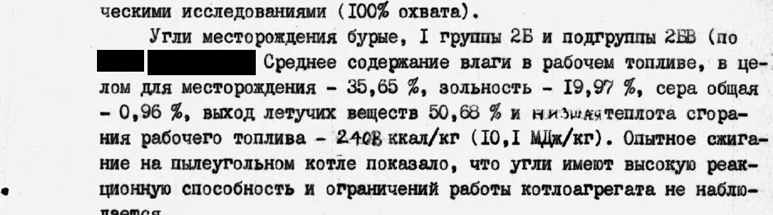
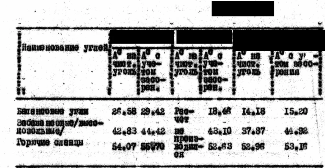
Fragment of an archival report, names hidden
QN-202

Copper

Kostanay Region · Copper mineralization of a secondary sulfide enrichment zone (as defined by the authors) in a weathering crust along a zone of tectonic dislocation and thrust; the ore body is vein-like (possibly a lens), dipping at 60–75°

Average for the ore body (authors' calculation from seven drill holes):

copper 4.73% at an average thickness of 2.53 m

  • The ore body lies at the junction of a large regional fault (dip 60–70°, displacement 300–400 m) with a series of other faults; the whole crush and weathering zone (about 200 m) carries copper, lead and zinc mineralization, with the maximum at the contact with limestones. Tectonic contact of red-colored sandstones and siltstones of the Upper Devonian with dolomitized limestones of the Upper Devonian; no intrusive rocks were encountered at the site
  • Ore body dimensions: about 200 m along strike and about 150 m down dip (150 and 100 m in the conclusion of the same report); thickness from 1.0 to 4 m, 2.53 m on average. 25–30 m above the main body a parallel zone 2–4 m thick with copper 0.3–0.65% is identified
  • Average for the ore body (the authors' calculation from seven drill holes): copper 4.73% at an average thickness of 2.53 m; range of copper contents in the body from 1.0 to 12%. In the author's table the sum of the thicknesses of the seven intersections is printed as 17.8 m, whereas the addition gives 18.8 m; at 18.8 m the average would be 4.48%
  • Average per working (drill-hole intersections, thickness — copper): 4.0 m — 7.80%; 1.2 m — 2.80%; 4.0 m — 2.32%; 1.0 m — 1.75%; 3.0 m — about 5.7% (a calculated value, the row is not fully printed in the source copy); 2.60 m — 3.60%; 3.0 m — 4.03%
  • Lead in the body averages 0.2–0.3%, zinc 0.1–0.3%, in individual samples up to 1–2%; in the oxidation zone copper from 0.1 to 0.65%, average 0.2–0.3%. In individual samples of lead-zinc mineralization in limestones (not the copper body), by spectral analysis silver up to 0.003%, gold up to 0.03 g/t
  • An external control analysis of four samples of the ore interval gave copper contents higher than the original ones (10.44; 12.70; 10.96 and 1.74%); the control is noted as “below the permissible” because of the small number of samples
  • The ore is a dark gray or black argillite-like clay with a small admixture of quartz sand and concretions of iron sulfides; ore minerals: chalcocite (61% of the heavy-mineral concentrate), native copper (17% of the concentrate), sphalerite, galena, pyrite, barite, apatite; in the oxidation zone chrysocolla, malachite, smithsonite, limonite
  • The weathering crust has elevated phosphorus: P2O5 in individual intervals 6–8%, in individual samples 14–17%. A small technological sample (2 kg, copper 10% in the original ore): a concentrate with copper 40.5% was obtained, but the yield was 4.1% and the recovery 16.6% because of the fine grain size of the ore (this is a beneficiation result, not a grade in the ore)
  • An approximate estimate by the authors: about 9 thousand t of copper (ore body volume 75,900 m³, ore density 2.5 t/m³, ore 189,750 t, copper 4.73%); no category — this is a forecast, not reserves
  • Level of study: core drilling, the ore body was intersected by seven drill holes (spacing along the profile 50 and 25 m, profiles 200 m apart), samples of 1.0–2.0 m from half of the core, chemical and spectral analysis. Primary ores were not intersected: in the dislocation zone the weathering crust descends 250–300 m; nine planned drill holes of 350 m each were not drilled (24% of the planned scope was completed), geophysics was not used, the form of the body at depth is unclear
Kostanay Region · approximate place, inside the circle
QN-203

Molybdenum, beryllium, tungsten

Pavlodar Region · Stockwork of quartz veinlets with molybdenite in biotite granites and alaskites with greisenization (the authors assign it to the stockwork type of rare-metal deposits); beryllium (beryl, phenakite) is linked to albitization and greisenization

Average for an ore interval of a drill hole (core sampling):

molybdenum 0.105% over 21 m

  • Two stockworks are outlined; the enriched parts are steeply dipping lenses and ore shoots in zones of the strongest fracturing. The beryllium halos do not coincide with the stockwork and molybdenum mineralization: they are confined to zones of fracturing, silicification, ferruginization, chloritization and fluoritization; ore minerals are molybdenite, pyrite, chalcopyrite, chalcocite, galena, bismuthinite
  • The stockwork, marked by halos of molybdenum, bismuth, tungsten and beryllium, covers about 6 sq. km; only the area of the molybdenum halo, about 1 sq. km, has been studied. A metallometric survey outlined a molybdenum dispersion halo up to 15 km long (up to 0.02% in samples); mineralization with elevated contents is traced to a depth of 95–125 m
  • Molybdenum in core drill holes (five holes about 100–200 m deep, core recovery 55–68.9%; the authors: core sampling gives “clearly understated contents”). Averages for ore intervals: 0.105% over 21 m, 0.072% over 16 m, 0.083% over 34 m, 0.058% over 83 m; range across samples 0.02–0.3%; in one interval core recovery is 38% and the authors doubt the reliability of the sampling
  • For the forecast calculation the authors adopted molybdenum 0.06% for the enriched zone (this is not an average for the whole stockwork and not an average for a body); the authors describe the whole mineralized stockwork as 0.03–0.04%; the weighted average of the four intervals above is about 0.07% by the authors' own calculation. In one drill hole below 147 m molybdenum drops sharply (to 0.01% in individual samples)
  • Trenches, molybdenum: ordinary values 0.01–0.06%, in individual samples and groups of samples 0.1–0.15%; in the central part of the halo, zones of 3–12 m with an average of 0.04% and higher; in one trench a zone 58 m long with an average of 0.06% (samples 0.02–0.3%) and a zone of 20 m with an average of 0.08%
  • Beryllium, photoneutron logging of one drill hole (not a chemical analysis and not core sampling): over an interval of 2.65 m the average BeO is 0.17% (three peaks up to 0.8%, the figure in the source document is smeared); two more short intervals of 0.1%. Core samples from the same drill hole showed no beryllium increase
  • Beryllium in trenches (photoneutron analysis of samples): ordinary samples are thousandths of a percent; one sample BeO 0.792% over a 1 m interval (the adjacent sample 0.065%, average over 2 m 0.428%; beryllium is not visible to the eye); single samples 0.089, 0.12 and 0.159%. Beryllium mineralization zones from tenths of a metre to 3 m thick with contents “from 0.1 to 0.8%” (range across zones); in one drill hole at a depth of 65–90 m separate beryl crystals and veinlet accumulations were found, and in a trench dump a beryl veinlet 2–3 mm thick
  • Later work by another team (trenches up to 550 m in total length): molybdenum 0.01–0.6% (range across samples), tungsten 0.001–0.003%, beryllium 0.0002–0.0003%, rarely up to 0.005% in individual samples; this work did not show elevated beryllium. Single wolframite disseminations are noted only in quartz veins
  • Geologists' forecast resources: an approximate calculation of 7.5 thousand t of molybdenum for the enriched zone of the stockwork (thickness 100 m, length 500 m, depth 100 m, bulk density 2.5 t/m³, content 0.06%); the dimensions were taken from the sampling plan and not outlined by workings; no category is given; this is a forecast, not reserves. The geologists did not calculate beryllium reserves
  • Level of study: route prospecting, metallometric survey, magnetic, electrical and gamma surveys, trenches, pits, core drilling of five holes; beryllium in samples from workings was analysed by the photoneutron method. The authors: the work carried out is “clearly insufficient” to assess the site for beryllium; the stockwork field has not been crossed entirely by workings
Pavlodar Region · approximate place, inside the circle
QN-204

Iron

Karaganda Region · Magnetic anomaly with meager magnetite, locally hematite-magnetite ores in bedded and lens-bedded lodes conformable with the host rocks; six thin lodes

Average for one drill-hole intersection (main ore bed):

iron 29.0% at a true thickness of 32.0 m

  • One of a group of objects strung out in a chain; according to the authors, the largest of the group. Host rocks are metamorphosed terrigenous-siliceous deposits of the Middle–Upper Ordovician (quartzites, schists, sandstones), the site lies in the exocontact of an Upper Paleozoic intrusion; the structure is the limb of a narrow overturned anticlinal fold (limb dips 70–80° and 50–60°), the ores lie mostly in the middle and lower parts of the quartzites or beneath them
  • Dimensions: the magnetic anomaly along the 100 gamma contour has parts about 2 km and about 1.6 km long, with a width down dip (for the longer part) of 300 m. By drilling, the ore bodies are traced for 400–600 m along strike and 400 m down dip; they pinch out quickly on the flanks and the ore thickness decreases somewhat with depth
  • The ore bodies are overlain by Neogene clays up to 100 m thick; ore intervals were intersected by drill holes at depths from 52 m to more than 350 m
  • Average per drill-hole intersection (number of samples not stated in the source): main ore bed — iron 29.0% at a true thickness of 32.0 m (in a later description the same interval: thickness 38 m, iron 29% in the text and 28% in the table of the same volume); upper bed — iron 38.8% at a true thickness of 4.0 m (38.3% in the table of the later description)
  • Two interbeds in the same drill hole: iron 23.0% at a thickness of 1.0 m (in the table of the later volume the thickness is 2 m; called a poor iron-manganese ore) and iron 18.32% at a thickness of 3.0 m. In other drill holes, intersections with iron from 7.6 to 35% (the lower values are meager interbeds)
  • Authors' estimate: the average iron content in the ore bodies is not more than 25%
  • Ore minerals: magnetite, less often hematite-magnetite. Full spectral analysis of grab samples of core of all rock varieties (not ore samples) showed no elevated contents; lead, zinc and copper are relatively elevated — 0.005–0.02%. In preliminary technological tests of the ores of the ore field as a whole (not of this site separately), magnetic separation gave a concentrate with an iron content of 50–67.5% at a recovery of up to 85% (this is a concentrate, not the grade in the ore)
  • Geologists' forecast resources — a forecast, not reserves: in the first estimate “possible reserves” of 7.2–20.8 million t (at a bulk density of 3 t/m³; the lower limit obtained by halving the parameters); in the later one “approximate reserves” of 50 million t at an iron content of 25%. There are no categories and no reserve calculation
  • Level of study: ground magnetic survey at a scale of 1:10 000, mapping and prospecting-and-evaluation drilling with geophysical logging of the drill holes; there is no information on mining in the sources
Karaganda Region · approximate place, inside the circle
QN-205

Phosphorite

Zhambyl Region · Bedded phosphorites; one phosphorite bed within a member of interbedded phosphorite conglomerate, fine- and medium-oolitic phosphorite and phosphatized chert; the bed is steep and the body extends as a narrow strip

Average for the section opened by trenches (range of averages):

P2O5 17–19%

  • The bed lies in a Lower Cambrian phosphorite-bearing sequence. Footwall: weakly phosphatized dolomites, P2O5 from 0.5 to 3.4%, thickness from 0 to 8 m. Hanging wall: two thin horizons — brown dolomites with Fe2O3 up to 9.42% and phosphatized siliceous dolomites (P2O5 from 2.1 to 14.8%, SiO2 from 18.53 to 70.36%, thickness from 0 to 4 m)
  • The rocks dip at 50–87°, the bed itself at 70–87°. A longitudinal fault separates the site from the neighbouring structure; the bed is offset by transverse and diagonal faults (displacement in plan from 5 to 60–70 m). In topographic lows the bedrock is covered by Quaternary deposits up to 15 m thick
  • Strike length: more than 12 km according to the basin reserve summary, 6.5 km according to an early estimate. A 4.5 km segment of the strip lies under thick loose deposits and was opened by one trench
  • Bed thickness from 9 trenches: from 0.2 to 2 m; in the conclusion of the same report — from 3.0 m to complete pinch-out, 1.5 m on average; in a chapter of the same report — from 5 m to complete pinch-out; according to the reserve summary — from 4 m to complete pinch-out. The author expects the bed to thicken with depth, up to 5.6 m (an expectation, not a measurement)
  • Average for the section opened by trenches: P2O5 17–19% (range of averages), maximum 22.7%. Average for the site according to the basin reserve summary: 17.49% P2O5; an early estimate gives 25% P2O5, basis of the estimate not stated
  • Phosphorite conglomerate, sample range: P2O5 6.10–20.55%, SiO2 11.14–20.46%, MgO 3.2–10.80%, CaO 30.8–43.12%. Phosphatized chert in the member: P2O5 from 7.3 to 9.25%
  • Fine-oolitic phosphorite, sample range: P2O5 17.0–22.7%, SiO2 8.05–41.18%, MgO 2.0–4.3%, CaO 28.28–43.54%
  • Phosphate occurs as oolites and phosphorite fragments; under the classification used in the basin the ores belong to the siliceous-carbonate type, siliceous-dolomitic variety, and on the flanks of the opened section to the siliceous-shale type. The elevated MgO content matters for beneficiation (up to 10.80% in the conglomerate); an iron-manganese horizon lies in the hanging wall of the bed
  • Level of study: geological mapping and prospecting, inclusion in the basin reserve summary, then prospecting and appraisal on part of the strip (detailed geological mapping, 9 trenches, sampling and chemical analyses); there are no drilling data on the site in our materials
  • Reserves: according to the basin reserve summary the reserves were classed as off-balance; our materials contain no reserve figures and no forecast estimate is given
Zhambyl Region · approximate place, inside the circle
QN-206

Lead

Karaganda Region · Lead (galena) mineralization in finely schistose crenulated schists; veinlets and disseminations of galena, rarely pyrite and chalcopyrite, cerussite and malachite in oxidized outcrops

Average over a 5 m drill-hole interval (chemical analysis):

lead 1.2%

  • Host rocks are Archean quartz-sericite and quartz-chlorite schists, dipping at 70–80°; there are dikes of gabbro and gabbro-amphibolite (Ordovician) and a massif of porphyritic diorite (Middle Devonian). The ore bodies and zones are confined to the hinge parts of a narrow high-order anticlinal fold; a fault 800 m long is known
  • Dimensions: ore zones in trenches 1 m and 2 m thick, 2–7 m and 2–19 m in other trenches; in one drill hole an ore body 5 m thick and an interval of visible galena 15 m long (per the final document); a single ore outcrop with an area of 100 sq. m. Areal secondary lead halos form three areas with a total area of the order of 10 sq. km
  • Drill-hole interval 5 m thick: average for the interval, lead 1.2% (chemical analysis); the final document gives “on average 2.5%” for the same interval (analysis method not named). The detailed sampling table covers only 3.2 m of the 5 m: three samples (1.0, 1.0 and 1.2 m) give 0.54, 0.53 and 1.25% by chemical analysis. Other zones in this hole: lead 0.006–0.4% (range)
  • Trenches, spectral analysis of channel samples: lead 0.1–1.5% (range across samples). The “averages” named in the text, 1.5% (three intervals 1–2 m wide) and 1% (four intervals), are spectral values (order of magnitude); in the table the chemical values of the same intervals are lower (for example 1.07, 1.21, 0.84%), so the author's text and table diverge. Two trenches intersected ore zones 1 m and 2 m thick with an average lead of 1% (method not named)
  • Other trenches: a trench of the gold-survey sub-area, mineralized zones 2–19 m, average lead 0.35%, gold 0.01–0.4 g/t (method and number of samples not named); six trenches of 300 cu. m, in two of them zones 2–7 m thick, lead 0.1–0.4% (range), in the rest such zones are rare and thin
  • Single ore outcrop (surface, ochreous): lead up to 10%, gold up to 4 g/t (“up to X”, single maxima); a trench across the outcrop: lead reaches 1.25% in two intervals of 1.0 m each, 0.3–0.8% in 14 samples
  • A drill hole in weakly intense halos (172 m): by semiquantitative spectral analysis lead reaches 0.01–0.28% in the intervals 3–18 m and 135–152 m, no visible lead mineralization. Secondary lead halos: average about 0.05% (0.007–0.02% predominates); gold for the area as a whole 0.01–0.5 g/t (rarely up to 4 g/t), ranges across samples
  • No reserves. Geologists' forecast resources from the secondary halos: lead 750,000 t (category not named; to a depth of 100 m, the correction factor 0.2 was written in by hand in the report, the areal productivity value is not filled in in the calculation, so the number cannot be reproduced); this is a forecast, not reserves. The authors of the first report state that the parameters of the geochemical field and the predicted resources cannot serve as criteria for assessing the scale of mineralization
  • Level of study: lithogeochemical survey, induced polarization electrical prospecting (including the downhole variant), trenches (six of 300 cu. m and five of 55 cu. m), two drill holes (101 m and 172 m). Sampling: drill hole, chemical analysis of the interval; trenches, mainly spectral analysis
Karaganda Region · approximate place, inside the circle
QN-207

Lead

Karaganda Region · Disseminated galena in a zone of ferruginization and manganization exposed by trenches; genetic type per the source: sedimentary-hydrothermal

Average for a zone of 7 m apparent thickness (trenches; number of samples not stated):

lead 2.6%, zinc 0.09%, silver 3 g/t

  • The zone is composed of disintegrated, intensely weathered carbonate rocks of the Upper Devonian (in one place the source also names Lower Carboniferous rocks), alternating with clay deposits, with fragments of red quartzite-like rocks with disseminated galena
  • Ore (mineralized) zone about 400 m long, apparent thickness 7 m; along strike in one direction the thickness of the mineralized interval decreases to 1.5 m. A thin (0.2 m) interbed of black fine-grained thin-bedded limestones with sparse disseminated galena is noted separately
  • From trenches: average for the zone of 7 m apparent thickness — lead 2.6%, zinc 0.09%, silver 3 g/t (number of samples not named in the source); on the flank, with a mineralized interval 1.5 m thick — lead 0.81%, zinc 0.2%, silver 0.6 g/t
  • Besides the described zone, trenches show intervals of up to 20 m composed of ochreous-clayey formations: lead 0.2–3.3% (range)
  • In another section of the same source, lead 0.8%, zinc 0.2%, silver 0.6 g/t are named for trench samples (the numbers coincide with the flank ones); in the description of the ore field in the same source, the ore zone is given as lead 2.6–3.3%, copper 0.5%
  • Level of study: lithochemical sampling at a scale of 1:10,000 and two trenches; drilling is not listed among the work
  • Geologists' forecast resources: lead to a depth of 200 m estimated by the author of the early work at 100 thousand t (category not stated, calculation parameters not given in the source); this is a forecast, not reserves
  • For the ore field that includes the occurrence, the source gives a calculation of category P3: lead 250 thousand t (parameters: ore zone length 1,000 m, thickness 10 m, depth 300 m, lead content 3.0%; a recalculation of these parameters gives about 243 thousand t); this is a forecast, not reserves
Karaganda Region · approximate place, inside the circle
QN-208

Lead, silver

Karaganda Region · Veinlet-disseminated galena mineralization (lead with silver) as lenses concordant with the strike of the rocks; genetic type per the source: volcanogenic-sedimentary

Range across samples, trenches (19 channel samples):

lead 0.012–1.0%, silver 0.3–3.0 g/t; the source gives no averages

  • Host rocks are fine-crystalline limestones of the Upper Devonian; besides galena (the main mineral), sphalerite, chalcopyrite and pyrite are noted in drill holes
  • Dimensions: four mineralization zones 10–60 m long, from 4–5 to 0.1–0.15 m thick (in another place in the source: zone width 0.1–5.0 m); the area of the occurrence is 3.85 km² (studied by magnetic survey), vertical electrical soundings covered 3.35 km²
  • Trenches (4 trenches, 19 channel samples in sections of 0.5–1.0 m and 0.1–0.2 m), range across samples: lead 0.012–1.0%, zinc 0.003–0.085%, manganese 0.03–1.0%, silver 0.3–3.0 g/t, barium 0.02–1.0%. The numbers are given as ranges or as “up to X”; the source gives no averages and does not disclose whether these are individual samples or interval averages
  • Drill holes (5 holes 100–120 m deep; 41 core samples from the five holes, not only in ore intervals): five ore intervals from 5 to 10.25 m thick with lead from 0.03 to 1.8%, copper up to 0.3%, silver from 0.5 to 8.1 g/t, zinc up to 0.25%; in addition, seven small intervals 0.25–1.5 m thick
  • In another place in the same source: for the same ore intervals thickness 4–10 m, lead 0.14–0.36%, silver 0.5–8.0 g/t, zinc 0.2%; for the trenches zinc 0.03–0.08%, silver 3.0 g/t
  • Secondary halo (an indicator, not a grade in ore): lead 0.03%, manganese 1.0%, silver 0.0001%, barium 0.3%, cadmium 0.0001%
  • Level of study: prospecting traverses, grab and channel samples, trenches, test pits, magnetic survey and vertical electrical soundings at a scale of 1:10,000, five prospecting drill holes (566 linear metres)
  • Reserves and forecast resources are not given in the source
Karaganda Region · approximate place, inside the circle
QN-209

Tungsten

Almaty Region · Quartz-scheelite mineralization in zones of silicification, crushing and brecciation; by genesis the authors assign it to meso-epithermal formations of quartz-scheelite-stibnite composition

Main lens, chemical analysis of trenches:

WO3 0.046–0.09% (range for the lens, not a weighted average)

  • The mineralization is distributed extremely unevenly and is clustered in character: small lenses and nests (the nests sometimes with high tungsten concentrations); the ore bodies are small mineralized lenses with low average tungsten contents. The occurrence is divided into three sites (main, second and third)
  • Host rocks are volcanogenic-sedimentary formations of the Visean and Namurian stages (tuff gravelstones, tuffaceous sandstones, siliceous tuffaceous siltstones, sandstones); dikes of intermediate composition are widely developed. The mineralization is confined to the zone of an ore-controlling regional fault and to the shear zones splaying from it (alteration zones from 2–4 to 15–30 m thick); in the authors' opinion the control is tectonic and lithological: the highest tungsten contents lie at the junctions of faults of different orientations and in silicified gravelstones
  • Main site: two zones of silicification, crushing and brecciation: the first 650 m long, 6–8 to 10–12 m thick; the second traced for 400 m, 8–12 m thick; the dip at the surface is 80–85°, according to drilling data the zone dips at 80° in the opposite direction. Mineralized lenses: the main one 45 m long, 3 m thick in the central part and 1 m on the flanks; two others 10–15 m long and 1 m thick
  • Second site: two subparallel silicification zones, the first up to 600 m long (with gaps) and 2–5 m thick, the second about 300 m long and 3–6 m thick; the tungsten samples form separate disconnected lenticles about 30 m long and 1 m thick. Third site: a crushing and brecciation zone 45–60 m wide, zones of veinlet silicification 2–5 m thick traced with gaps for 1.2 km. Overall the lenses are a few meters long, sometimes a few tens of meters, 1 m thick, up to 3 m in swells
  • Main site, chemical analysis of trenches: WO3 0.046–0.09% for the main lens and 0.091–0.11% for two small lenses (ranges by lens, not weighted averages); the author notes that the small lens with the higher content (up to 0.11%) is possibly a nest, was not intersected by a drill hole and is not traced along strike in the trenches. Drill-hole core: an interval of 2 m true thickness with tungsten 0.05–0.09% (spectral analysis), the continuation of the main lens at depth; with depth the tungsten content does not change substantially
  • Spectral analysis of trenches, main site (98 channel samples and 81 geochemical samples): tungsten in 20 samples, in six of them 0.04–0.09% (confirmed by chemical analysis), in eight 0.001–0.005%, in the rest 0.0005–0.0008%. Second site: tungsten in only 5 samples, 0.01–0.05% (25 channel and 29 geochemical samples). Third site: tungsten in 8 samples, in three of them 0.01–0.03%, in the rest 0.001–0.0005% (50 channel and 44 geochemical samples)
  • Single samples: one spot geochemical sample with visible scheelite from the silicification zone, WO3 18.6% (single sample; the author generalizes the same value as “in nests up to 18.6%”, there is no second measurement); one geochemical sample, tungsten 0.3% (spectral analysis), taken in a zone of the second site and not included in its 5 samples. Of 310 geochemical samples, tungsten was found in 30 (0.005–0.016%) and in one (0.3%)
  • Scheelite is the main ore mineral (fine-grained segregations 1–2 mm, less often up to 1.5–2.0 cm); pyrite, arsenopyrite, galena (single grains), stibnite; quartz is the gangue mineral. In 66 heavy-mineral samples: single grains of scheelite in 22, weight contents in 8. Accompanying elements (spectral analysis of geochemical samples): antimony 0.01–0.03% (up to 0.1% in individual samples, up to 1% in one), arsenic 0.005–0.06%, molybdenum up to 0.003%, lead 0.004–0.015%. Gold: not detected by special analysis in 20 samples of the main site and 10 samples of the second site; 2 gold grains in one heavy-mineral sample; there is no numerical gold content
  • Level of study: prospecting traverses, heavy-mineral sampling over 8 km², geochemical sampling (310 samples), a geological map at 1:10,000, trenches (12 at the main site, 124.4 m³; 5 at the second, 61.8 m³; 3 at the third, 61.8 m³ — both volumes are printed identically in the source), drilling of 181.4 m (two holes: the first did not intersect the ore zone because of a change in its dip, the second, a counter hole, did); 45 core samples and 75 geochemical core samples were taken. Reserves and forecast are not given in the source materials
Almaty Region · approximate place, inside the circle
QN-210

Iron

Almaty Region · Iron ore occurrence: five ore bodies of submeridional strike over an area of about 100 × 150 m; according to the authors, the mineralization is uniform

Average for the ore body (the largest of five; channel samples, trenches, chemical analysis):

iron 33.17%

  • In the typescript the ore mineral is not named; in a handwritten insertion on the page the ore bodies are called hematite bodies
  • The ore bodies are confined to a tectonically bounded area among jasperoids of tentatively Sinian age and green-colored sandstones of the Upper Silurian; within it there is an outcrop of diabase porphyrites with jasper interbeds; details of the structural control are not given in the source
  • First (largest) body: length 62 m, thickness 9–15 m, average 13 m. Second: length 37 m, average thickness 6.3 m. Third: length 46 m, thickness 4–10 m (average 7 m). The remaining two bodies are thinner: average thickness 1–2 m, extent 8–50 m
  • Chemical analysis of channel samples (channels 2 m long at 2 m spacing, 51 samples from 13 trenches; arithmetic means). First body: iron from 16–19% to 43.05% (range across samples), average for the body 33.17%; the lower content is explained by the inclusion of selvages in the sampling (dilution)
  • Second body: iron from 31% to 47.4%, average for the body 36.7%; third body: from 33.4% to 36.9%, average for the body 34.94%; remaining bodies: iron 30–40% (chemical analysis of channel samples, range across samples)
  • Average for the occurrence as a whole, the authors' estimate: iron 35–36% (the calculation is not given in the source)
  • Spectral analysis of channel samples (order of magnitude): copper from 0.01 to 0.1–0.2% (in all samples), zinc 0.1–0.5%, lead 0.02–0.05%, molybdenum from traces to 0.005%, arsenic 0.01–0.2%, cobalt 0.01–0.02%, germanium 0.002–0.005%, nickel 0.01–0.02%, traces of gallium; phosphorus in single samples below 1%, manganese in most samples 1% and more
  • Level of study: a schematic geological map at 1:1000 scale, 13 trenches, 51 channel samples; no drill holes, the depth of the bodies has not been studied
  • Geologists' forecast resources: for the occurrence as a whole, iron hardly exceeds 150–200 thousand t (no categories, no calculation); this is a forecast, not reserves
Almaty Region · approximate place, inside the circle
QN-211

Lead

Almaty Region · Hydrothermal (as defined by the authors) lead mineralization: quartz-calcite veins and veinlets with disseminated galena and small galena lenses, and smears of malachite and azurite, in a crush zone

Average for a trench over a 1.3 m interval (authors' calculation; the interval includes a sample of the galena itself):

lead 10.1%

  • Ore bodies are lens- and nest-shaped, up to 1.3 m thick and up to 140 m long; the thickness decreases sharply with depth. The crush zones are traced by trenches for 1,200 m, with a thickness from 1 to 10–12 m
  • Quartz-calcite veinlets are from 2–3 mm to 3–4 cm thick (20 cm in one trench); galena disseminations rarely reach 1 × 0.5 cm. In one trench a galena lens 10 cm thick and about 1.5 m long was encountered
  • Host rocks: sandstones, siltstones and chloritized schists of the Upper Cambrian – Lower Ordovician, broken by tectonic fractures linked to fault zones (brecciation, ferruginization, leaching voids after sulfides); elevated contents of lead, gold and silver are confined to one of the fault zones
  • Chemical analysis from trenches: lead 0.49–8.75% in the fault zone (range across samples)
  • Average for a trench over a 1.3 m interval: lead 10.1% (the authors' calculation; the interval includes a sample of the galena itself; a recalculation from the sampling table, weighted by length over three samples, gives about 11.5%)
  • Associated components (ranges across samples from two trenches, not tied to the 1.3 m interval): by chemical analysis molybdenum 0.03–0.32%, cobalt 0.01–0.021%; by spectral analysis (order of magnitude) copper 0.004–0.1%, zinc 0.004–0.01%, arsenic 0.003–0.025%, bismuth up to 0.002%, antimony up to 0.1%
  • Single samples of the galena itself (a mineral, not ore): lead 60 and 86%, silver up to 354 g/t, gold up to 0.1 g/t. The maximum gold in the authors' text is 0.3 g/t (a single sample of schists in the hanging wall of the lens); in the sampling table one schist sample is printed as 0.4 g/t
  • In two drill holes 176 and 104 m deep the contents are mostly background: lead 0.0005–0.008% (only in the 0–2 m interval 0.04%); in breccia after schists with native copper and chalcopyrite copper 0.08% (0.1 m interval); the contents decrease sharply with depth
  • Level of study: 19 trenches (total volume 264 m³), 55 channel and 36 composite point samples; deep geochemical prospecting over an area of 3.5 × 3.5 km on an 800 × 50 m grid gave background contents; two drill holes sited as a fork in the line of one of the trenches
  • Reserves and forecast resources are not given in the source materials.
Almaty Region · approximate place, inside the circle
QN-212

Zinc, lead, molybdenum

Almaty Region · Molybdenum-lead (polymetallic) mineralization with zinc in zones of tectonic dislocation of felsic effusives showing signs of hydrothermal alteration

Average for a drill-core interval (spectral analysis, 22.1 m along the hole, true thickness not given):

zinc 0.69%, lead 0.31%, molybdenum 0.04%

  • Host rocks: gently dipping felsic effusives of the upper member of the Upper Carboniferous (tuff-lavas of dacite porphyry, fluidal and spherulitic lavas of quartz porphyry, locally intensely pyritized); overlain by a thin cover of Quaternary deposits 0.5–3.0 m thick
  • Two zones of tectonic dislocation cut the fluidal quartz-porphyry lavas; the most abundant polymetallic and molybdenum mineralization, like the radioactive anomaly, is confined to these zones. Near the surface the mineralization is represented by secondary minerals; in the drill-hole core, dissemination of pyrite, galena and sphalerite and signs of leaching (limonite after pyrite, voids) down to the bottom of the hole (87.8 m); the oxidation zone, according to the author, is deep
  • Detailed work area 0.15 km². Ore zone in the trench 3.0 m thick (sampling interval 0–4 m); ore interval in the core of the vertical drill hole 34.0–56.1 m (22.1 m along the hole, true thickness not given)
  • Average for the trench (channel sampling, interval 0–4 m, ore zone 3.0 m): spectral analysis – molybdenum 0.098%, lead 2.16%, copper 0.11%, bismuth 0.006%; chemical analysis of the same interval – molybdenum 0.26%, lead 2.36%. In individual samples (single maxima): molybdenum 0.735%, lead 6.35% (number of samples not stated)
  • Average for the drill-core interval 34.0–56.1 m (spectral analysis): molybdenum 0.04%, lead 0.31%, copper 0.023%, zinc 0.69%; in individual samples lead up to 1.25%, zinc up to 5.0% (single samples)
  • Average for the test pit (interval 0.75–2.15 m, spectral and gold analyses): molybdenum 0.016%, lead 4.37%, zinc 0.20%, copper 0.27%, silver 0.0004%; one sample (single sample): lead 10% and gold 1.25 g/t. Zinc was not detected in the channel samples from the trenches; the author explains this by leaching of zinc from the near-surface oxidation zone
  • Dispersion halos by metallometric survey: lead 0.01–0.1%; in the final document of the work, for a group of halos, lead 0.06–0.15% and zinc 0.01–0.04% are given. Two areas of elevated radioactivity by radiometry (this is not metal grade): 16,000 m² and 1,500 m²
  • Oxidation-zone minerals: cerussite, malachite, wulfenite, limonite, manganese hydroxides; in the core – pyrite, galena, sphalerite. Associated: copper, bismuth, vanadium, strontium, arsenic, uranium (0.017% by chemical analysis of the trench interval), traces of silver and beryllium
  • Level of study: schematic geological and metallometric surveys at a large scale, walking gamma survey, trenches (the number is given differently in the source: 9 and 7), five test pits up to 2.7 m deep, one vertical drill hole with gamma logging; 23 channel and 50 core samples, 403 metallometric samples for uranium. The checking of the halos is unfinished; the drill-hole sampling is spectral
  • The source has no calculation of reserves or forecast resources.
Almaty Region · approximate place, inside the circle
QN-213

Gold, copper, silver

Karaganda Region · Gold-copper-silver mineralization with molybdenum and lead in silicification zones and zones of disseminated sulfide mineralization

Average for a drill-hole interval (the best described interval, 2.8 m; number of samples not stated):

gold 1.34 g/t, silver 10.0 g/t, copper 0.70%

  • Ore minerals: pyrite, chalcopyrite, galena, sphalerite, rutile, rarely hematite, chalcocite, goethite; by-products zinc up to 0.1% and tin up to 0.006% (earlier data, low contents)
  • Host rocks: intrusive rocks of intermediate composition; in the surroundings, volcanogenic and carbonate rocks and dikes of felsic composition; about 30% of the area is covered by Quaternary deposits. The mineralization is confined to silicification zones in the host intrusive rocks
  • Three silicification zones have been identified, 950 m long in total, with an average thickness of 9 m; the zones were assessed to a depth of 100 m. For the forecast calculation an ore-bearing zone area of 90,087 m² was adopted, with a total thickness of potential ore-bearing levels of 10.6 m
  • Average for drill-hole intervals (number of samples in the interval not stated): the best described interval is 2.8 m – gold 1.34 g/t, silver 10.0 g/t, copper 0.70%, lead 0.45%, molybdenum 0.006%; in other intervals (1 to 15 m) gold 0.015–0.47 g/t, in some intervals silver 1.65–12.82 g/t, copper 0.01–0.40%, lead 0.03–0.47%, molybdenum 0.0002–0.02%
  • Samples from silicification zones (range across samples): gold 0.029–0.635 g/t. Range of “elevated contents” in the authors' summary (the upper limits do not occur in the descriptions of individual intervals and are not tied to samples): gold 0.1–3.12 g/t, silver 1.0–20.72 g/t, copper 0.1–1.04%, molybdenum 0.0001–0.06%, lead 0.1–1.06%
  • Earlier data: gold in channel samples 0.02–0.04 g/t (maximum up to 1.5 g/t), in drill holes mostly not more than 0.015 g/t (maximum 1.5 g/t); in one drill hole, by fire assay, gold averages 13 g/t over a 5 m interval and one vein sample gave 15 g/t (single sample; in the summary table the maximum for channel samples is 1.5 g/t, the figures disagree). A control drill hole of the modern work, drilled to check this hole, showed no high grades (maximum 0.47 g/t)
  • Level of study: earlier work – induced polarization electrical survey, drill holes and trenches; modern work – core drilling, geophysics, core sampling, petrographic and mineralogical studies
  • Predicted resources of category P1 (forecast, not reserves): ore 5.195 million t, gold 1.662 t at an average of 0.32 g/t (cut-off grade 0.1 g/t, bulk density 2.87 t/m³); by-product silver per the authors' table 40.857 t (7.90 g/t)
Karaganda Region · approximate place, inside the circle
QN-110

Coal

Akmola Region

Prognostic coal resources (initial estimate under Soviet category C2):

200–500 million t

  • Hard coal, thermal grade; coals of this sequence in the district belong to grades K and G (К, Г), weakly caking, difficult to wash
  • Lower Carboniferous coal-bearing sequence about 300 m thick; the lower coal horizon is of economic interest
  • Two workable seams, combined seam thickness 29 m; coal-bearing field area about 40 km²
  • Ash content 30 to 50%; the balance estimate included coals with ash up to 45% and seam thickness from 1.5 m
  • Stage: prospecting and evaluation; on this basis a category C2 estimate was made in Soviet times, later reclassified as prognostic resources because exploration was sparse
  • Mining method: underground (given the depth of the seams)
  • Standard: Soviet classification (category C2, prognostic resources), this is not JORC

No active exploration or mining licences (per our check against the map)

Checked 12.11.2026; not an official extract.

Akmola Region · approximate place, inside the circle
QN-111

Coal

Pavlodar Region

Prognostic resources, category P2, to a depth of 300 m (geologists' estimate):

500 million – 1 billion t

  • Brown coal (lignite), Jurassic; coal-bearing graben about 8 by 10 km, area about 80 km²
  • Lower Jurassic coal-bearing deposits up to 400 m thick (per gravity survey) are covered by 150 to 200 m of loose sediments
  • A prospecting borehole intersected a brown coal seam 27 m thick in total (15 m of clean coal) at a depth of 250 to 300 m; below it, several more seams 0.6 to 2 m thick
  • Ash 15 to 22%, moisture 8 to 10%, volatile matter (dry ash-free basis) 42 to 46%
  • Gross calorific value (dry ash-free basis) 26.8–27.9 MJ/kg (6,400–6,650 kcal/kg per the report); net calorific value as received is not given in our materials
  • Level of study: coal presence established by two geological mapping boreholes
  • Mining method: underground (given the depth)
  • Standard: prognostic resources, category P2 of the Soviet classification, this is not JORC

No active exploration or mining licences (per our check against the map)

Checked 12.11.2026; not an official extract.

Pavlodar Region · approximate place, inside the circle
QN-04

Gold, zinc

Kyzylorda Region · Ore occurrence

Best interval (average over the interval):

gold 3.47 g/t

  • The report's author assessed the object negatively — by the cut-off standards and economics of that time
  • Nearby — a mineralisation point. Maximum in a single sample: zinc up to 1%

Free of exploration and mining licences, within the state subsoil fund management programme (PUGFN) area (per our check against the map)

Checked 11.11.2026; not an official extract.

Kyzylorda Region · approximate place, inside the circle
Fragment of an archival report, names hidden
QN-101

Coal

Kostanay Region

Reserves, categories A+B+C1 (Soviet calculation, approved by the USSR State Reserves Committee (GKZ)):

over 1 billion t

  • Brown coal, thermal (grade 2B (2Б)), non-coking
  • Stage: detailed exploration completed, reserves approved; on the state register as of 01.01.2011
  • Net (lower) calorific value, as-received (working) fuel: 12–15 MJ/kg (2,950–3,542 kcal/kg per the report)
  • Sulphur about 1.2% on a dry-fuel basis; ash content about 20%, moisture about 34% (per the State Balance; the scan shows ash content of dry coal 24%)
  • Low-melting ash: the boiler should be selected with slagging in mind
  • Mining method: open-pit; the Soviet design provides for an open-pit mine of 25 million t of coal per year
  • The report's author named the deposit the most promising for priority development among the deposits explored in detail in its district
  • Reserve standard: Soviet classification (A, B, C1), this is not JORC

No active exploration or mining licences (per our check against the map)

Checked 11.11.2026; not an official extract.

Kostanay Region · approximate place, inside the circle
Fragment of an archival report, names hidden
QN-102

Coal

Kostanay Region

Reserves, categories A+B+C1 (Soviet calculation, approved by the USSR State Reserves Committee (GKZ)):

over 1 billion t

  • Brown coal, thermal (grade 2B (2Б)), non-coking
  • Stage: detailed exploration, reserves approved; a Soviet feasibility study (TEO) exists
  • Calorific value about 15 MJ/kg (as-received (working) fuel, per the State Balance)
  • Ash content of clean coal on average about 16% (per the TEO)
  • Sulphur on average about 2.4% — high: desulphurisation or blending with low-sulphur coal is needed
  • Mining method: open-pit; the TEO provides for one open pit of 20 million t of coal mass per year, average stripping ratio about 3.7 m³/t
  • Reserve standard: Soviet classification (A, B, C1), this is not JORC

No active exploration or mining licences (per our check against the map)

Checked 11.11.2026; not an official extract.

Kostanay Region · approximate place, inside the circle
Fragment of an archival report, names hidden
QN-17

Lead

Zhambyl Region · Ore occurrence

Maximum in a single sample:

lead up to 12%

  • The report's author assessed the object negatively — by the cut-off standards and economics of that time

Free of exploration and mining licences at the coordinate given in the report, within the state subsoil fund management programme (PUGFN) area; an active exploration licence lies nearby, and the object's position is known only approximately (per our check against the map)

Checked 11.11.2026; not an official extract.

Zhambyl Region · approximate place, inside the circle
Fragment of an archival report, names hidden
QN-103

Coal

Kostanay Region

Reserves, categories A+B+C1 (Soviet calculation, approved by the USSR State Reserves Committee (GKZ)):

over 1 billion t

  • Brown coal, thermal (grade 2B (2Б)), non-coking
  • Stage: detailed exploration, reserves approved; a Soviet technical council recognised the deposit as prepared for industrial development
  • Net (lower) calorific value, as-received (working) fuel: about 13 MJ/kg
  • Ash content about 16% (about 18% including dilution), moisture about 33%
  • Sulphur on average about 2.7%; more than half of the reserves have sulphur no higher than 2% (per the report)
  • Mining method: open-pit; a Soviet design institute considered open-pit mines
  • A railway crosses the deposit area
  • Reserve standard: Soviet classification (A, B, C1), this is not JORC

No active exploration or mining licences on the area; there is an active exploration licence in the vicinity (per our check against the map)

Checked 11.11.2026; not an official extract.

Kostanay Region · approximate place, inside the circle
Fragment of an archival report, names hidden
QN-106

Coal

Kostanay Region

Reserves, categories A+B+C1 (Soviet calculation, approved by the USSR State Reserves Committee (GKZ)):

200–500 million t

  • Brown coal, thermal (grade 2B (2Б)), non-coking
  • Stage: explored, reserves approved; on the state register as of 01.01.2011
  • Net (lower) calorific value, as-received (working) fuel: about 10 MJ/kg
  • Ash content about 20%, sulphur about 1%, moisture about 36%
  • Mining method: open-pit; Soviet materials refer to an open-pit mine
  • Reserve standard: Soviet classification (A, B, C1), this is not JORC

No active exploration or mining licences (per our check against the map)

Checked 11.11.2026; not an official extract.

Kostanay Region · approximate place, inside the circle
Fragment of an archival report, names hidden
QN-107

Coal

Akmola Region

Reserves, categories A+B+C1 (Soviet calculation, on the state register):

200–500 million t

  • Brown coal, thermal (grade 2B (2Б)), non-coking
  • Besides A+B+C1, about the same amount of category C2 reserves is on the register
  • Calorific value about 13 MJ/kg (per the State Balance)
  • Sulphur about 0.7% — low; ash content about 18%, moisture about 32%
  • Mining method not determined: two thick seams and a series of thin ones at depths of 110–570 m; prospecting did not identify areas for open-pit mining
  • Reserve standard: Soviet classification (A, B, C1, C2), this is not JORC

No active exploration or mining licences (per our check against the map)

Checked 11.11.2026; not an official extract.

Akmola Region · approximate place, inside the circle
QN-108

Coal

Kostanay Region

Reserves, category C1 (Soviet calculation, approved by a technical council):

50–200 million t

  • Brown coal, thermal (grade 2B (2Б)), non-coking
  • Stage: preliminary exploration; reserves approved by a technical council, not by GKZ
  • Calorific value of the as-received (working) fuel about 12 MJ/kg (per the State Balance); the scan gives the calorific value of laboratory fuel, dry fuel and combustible mass
  • Sulphur about 0.6%, moisture about 31%
  • Seams nearly horizontal, main seam over 15 m thick
  • Mining method: Soviet materials consider open pits and one underground mine; the report's authors judged the data insufficient for a final choice of method
  • Reserve standard: Soviet classification (C1), this is not JORC

No active exploration or mining licences on the area; at the boundary there is an active exploration licence (per our check against the map)

Checked 11.11.2026; not an official extract.

Kostanay Region · approximate place, inside the circle
Fragment of an archival report, names hidden
QN-109

Coal

Karagandy Region

Reserves, categories A+B+C1 (Soviet calculation, in the State Balance as of 01.01.2011):

200–500 million t

  • Hard coal, coking (grades Zh, KZh, K, OS (Ж, КЖ, К, ОС))
  • Stage: reserve area for an underground mine; besides A+B+C1, category C2 reserves are on the register
  • Ash content 10–30% (per the State Balance)
  • Mining method: underground; reserves calculated to a depth of 600 m
  • In a coal district with operating mines and a railway
  • Reserve standard: Soviet classification (A, B, C1, C2), this is not JORC

No active licences over most of the area; at the boundary there is an active right (per our check against the map)

Checked 11.11.2026; not an official extract.

Karagandy Region · approximate place, inside the circle

QN-A03Exploration plot · licence application filed

Tuff (facing stone): exploration plot next to an approved deposit

Tuff, facing and wall stone (common minerals) · Almaty Region, about 160 km from Almaty · exploration application 2026

m³ of B+C₁ tuff reserves at the neighbouring deposit (approved 2009), not this plot
3.06 million
block yield at the neighbouring deposit (test quarry)
43.8%
from Almaty, near the Almaty–Taldykorgan highway
≈ 160 km

Price: ₸20,000,000

Exploration licence application filed; licence being issued.

Checked 14.10.2026 per the applicant. We verify the application status before the deal.

QN-A02Exploration licence · deal form to be clarified

Matak placer gold: exploration licence with 2024 test pitting

Gold, placer (solid minerals) · Matak, Kalba, Samar District, East Kazakhstan · licence 2417-EL to 2030

C₂ gold in two valley sections, author's 2024 estimate, not approved
≈ 90 kg
test pits and 1,179 samples, 2024 exploration
375
exploration licence area, valid to 2030
22.5 km²

Price: $1,000,000

Exploration licence to 2030; transfer of the right allowed since 2025.

Checked 06.10.2026 against the unified subsoil-use geoportal; not an official extract. We re-check before the deal.

seller’s photos

QN-A01Operating asset · sale of 100% of the subsoil user

Crushed-stone quarry with a crushing and screening plant

Construction stone (common minerals) · Almaty Region, about 10 km from Konaev · mining since 2011

thousand m³ of balance reserves as of 1 Jan 2025, Kazakhstan State Reserves Committee (GKZ)
3,081.76
thousand m³ per year — design output
315
crushing plant capacity
250 t/h

Mining contract since 2011; extension to 2035 is under approval.

Checked 11.10.2026 based on the seller’s documents. We verify the status with state authorities before any deal.

Video 0:59 · seller’s photos
Contact