Skip to content

Molybdenum · Areas

Our geologists studied the geology from archival reports. Name, coordinates and materials — after an NDA.

Areas
Illustration

Found: 9

QN-203

Molybdenum, beryllium, tungsten

Pavlodar Region · Stockwork of quartz veinlets with molybdenite in biotite granites and alaskites with greisenization (the authors assign it to the stockwork type of rare-metal deposits); beryllium (beryl, phenakite) is linked to albitization and greisenization

Average for an ore interval of a drill hole (core sampling):

molybdenum 0.105% over 21 m

  • Two stockworks are outlined; the enriched parts are steeply dipping lenses and ore shoots in zones of the strongest fracturing. The beryllium halos do not coincide with the stockwork and molybdenum mineralization: they are confined to zones of fracturing, silicification, ferruginization, chloritization and fluoritization; ore minerals are molybdenite, pyrite, chalcopyrite, chalcocite, galena, bismuthinite
  • The stockwork, marked by halos of molybdenum, bismuth, tungsten and beryllium, covers about 6 sq. km; only the area of the molybdenum halo, about 1 sq. km, has been studied. A metallometric survey outlined a molybdenum dispersion halo up to 15 km long (up to 0.02% in samples); mineralization with elevated contents is traced to a depth of 95–125 m
  • Molybdenum in core drill holes (five holes about 100–200 m deep, core recovery 55–68.9%; the authors: core sampling gives “clearly understated contents”). Averages for ore intervals: 0.105% over 21 m, 0.072% over 16 m, 0.083% over 34 m, 0.058% over 83 m; range across samples 0.02–0.3%; in one interval core recovery is 38% and the authors doubt the reliability of the sampling
  • For the forecast calculation the authors adopted molybdenum 0.06% for the enriched zone (this is not an average for the whole stockwork and not an average for a body); the authors describe the whole mineralized stockwork as 0.03–0.04%; the weighted average of the four intervals above is about 0.07% by the authors' own calculation. In one drill hole below 147 m molybdenum drops sharply (to 0.01% in individual samples)
  • Trenches, molybdenum: ordinary values 0.01–0.06%, in individual samples and groups of samples 0.1–0.15%; in the central part of the halo, zones of 3–12 m with an average of 0.04% and higher; in one trench a zone 58 m long with an average of 0.06% (samples 0.02–0.3%) and a zone of 20 m with an average of 0.08%
  • Beryllium, photoneutron logging of one drill hole (not a chemical analysis and not core sampling): over an interval of 2.65 m the average BeO is 0.17% (three peaks up to 0.8%, the figure in the source document is smeared); two more short intervals of 0.1%. Core samples from the same drill hole showed no beryllium increase
  • Beryllium in trenches (photoneutron analysis of samples): ordinary samples are thousandths of a percent; one sample BeO 0.792% over a 1 m interval (the adjacent sample 0.065%, average over 2 m 0.428%; beryllium is not visible to the eye); single samples 0.089, 0.12 and 0.159%. Beryllium mineralization zones from tenths of a metre to 3 m thick with contents “from 0.1 to 0.8%” (range across zones); in one drill hole at a depth of 65–90 m separate beryl crystals and veinlet accumulations were found, and in a trench dump a beryl veinlet 2–3 mm thick
  • Later work by another team (trenches up to 550 m in total length): molybdenum 0.01–0.6% (range across samples), tungsten 0.001–0.003%, beryllium 0.0002–0.0003%, rarely up to 0.005% in individual samples; this work did not show elevated beryllium. Single wolframite disseminations are noted only in quartz veins
  • Geologists' forecast resources: an approximate calculation of 7.5 thousand t of molybdenum for the enriched zone of the stockwork (thickness 100 m, length 500 m, depth 100 m, bulk density 2.5 t/m³, content 0.06%); the dimensions were taken from the sampling plan and not outlined by workings; no category is given; this is a forecast, not reserves. The geologists did not calculate beryllium reserves
  • Level of study: route prospecting, metallometric survey, magnetic, electrical and gamma surveys, trenches, pits, core drilling of five holes; beryllium in samples from workings was analysed by the photoneutron method. The authors: the work carried out is “clearly insufficient” to assess the site for beryllium; the stockwork field has not been crossed entirely by workings
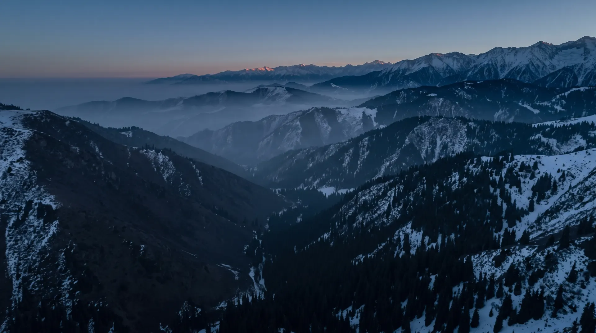
Pavlodar Region · approximate place, inside the circle
QN-212

Zinc, lead, molybdenum

Almaty Region · Molybdenum-lead (polymetallic) mineralization with zinc in zones of tectonic dislocation of felsic effusives showing signs of hydrothermal alteration

Average for a drill-core interval (spectral analysis, 22.1 m along the hole, true thickness not given):

zinc 0.69%, lead 0.31%, molybdenum 0.04%

  • Host rocks: gently dipping felsic effusives of the upper member of the Upper Carboniferous (tuff-lavas of dacite porphyry, fluidal and spherulitic lavas of quartz porphyry, locally intensely pyritized); overlain by a thin cover of Quaternary deposits 0.5–3.0 m thick
  • Two zones of tectonic dislocation cut the fluidal quartz-porphyry lavas; the most abundant polymetallic and molybdenum mineralization, like the radioactive anomaly, is confined to these zones. Near the surface the mineralization is represented by secondary minerals; in the drill-hole core, dissemination of pyrite, galena and sphalerite and signs of leaching (limonite after pyrite, voids) down to the bottom of the hole (87.8 m); the oxidation zone, according to the author, is deep
  • Detailed work area 0.15 km². Ore zone in the trench 3.0 m thick (sampling interval 0–4 m); ore interval in the core of the vertical drill hole 34.0–56.1 m (22.1 m along the hole, true thickness not given)
  • Average for the trench (channel sampling, interval 0–4 m, ore zone 3.0 m): spectral analysis – molybdenum 0.098%, lead 2.16%, copper 0.11%, bismuth 0.006%; chemical analysis of the same interval – molybdenum 0.26%, lead 2.36%. In individual samples (single maxima): molybdenum 0.735%, lead 6.35% (number of samples not stated)
  • Average for the drill-core interval 34.0–56.1 m (spectral analysis): molybdenum 0.04%, lead 0.31%, copper 0.023%, zinc 0.69%; in individual samples lead up to 1.25%, zinc up to 5.0% (single samples)
  • Average for the test pit (interval 0.75–2.15 m, spectral and gold analyses): molybdenum 0.016%, lead 4.37%, zinc 0.20%, copper 0.27%, silver 0.0004%; one sample (single sample): lead 10% and gold 1.25 g/t. Zinc was not detected in the channel samples from the trenches; the author explains this by leaching of zinc from the near-surface oxidation zone
  • Dispersion halos by metallometric survey: lead 0.01–0.1%; in the final document of the work, for a group of halos, lead 0.06–0.15% and zinc 0.01–0.04% are given. Two areas of elevated radioactivity by radiometry (this is not metal grade): 16,000 m² and 1,500 m²
  • Oxidation-zone minerals: cerussite, malachite, wulfenite, limonite, manganese hydroxides; in the core – pyrite, galena, sphalerite. Associated: copper, bismuth, vanadium, strontium, arsenic, uranium (0.017% by chemical analysis of the trench interval), traces of silver and beryllium
  • Level of study: schematic geological and metallometric surveys at a large scale, walking gamma survey, trenches (the number is given differently in the source: 9 and 7), five test pits up to 2.7 m deep, one vertical drill hole with gamma logging; 23 channel and 50 core samples, 403 metallometric samples for uranium. The checking of the halos is unfinished; the drill-hole sampling is spectral
  • The source has no calculation of reserves or forecast resources.
Almaty Region · approximate place, inside the circle
QN-222

Tungsten, molybdenum, bismuth, tin, zinc, lead

East Kazakhstan Region · A tungsten-molybdenum ore occurrence in quartz, quartz-greisen and quartz-topaz veins; among the ore metals, bismuth, tin, lead and zinc have also been established

Ranges by samples (chemical and spectral analysis; not an average):

tungsten 0.001–0.04%

  • Host rocks: granites of the late Upper Paleozoic; the authors associate tungsten and molybdenum with intrusions of the Late Upper Paleozoic complex
  • Dimensions: one quartz-greisen vein and six quartz veins. According to one description the maximum vein thickness is 4.1 m and the length is not more than 150 m; according to another description the thickness is up to several metres and the length up to 500 m
  • Grades according to the first description (“up to” values; number of samples not stated; the analysis method is named only for molybdenum in quartz veins — spectral): in the quartz-greisen vein tungsten up to 0.1%, lead and zinc up to 0.1%, molybdenum and tin a few thousandths of a percent, copper traces; for the ore occurrence as a whole tin 0.003–0.005% (method and number of samples not stated); in quartz veins molybdenum up to 0.05%
  • Grades according to the second description (chemical and spectral analysis; ranges, not averages): bismuth 0.005–0.02%; molybdenum 0.001–0.05%; tungsten 0.001–0.04%; tin from traces to 0.05%. The numbers of the two descriptions have not been averaged
  • Ore minerals: in heavy-mineral concentrates near the vein — cassiterite, wolframite, malachite, basobismutite (mineralogical data of the concentrates, not grades)
  • Level of study: trenches with a total volume of 193 m³, 189 channel samples, a lithogeochemical survey on a 100 by 20 grid
  • Reserves and predicted resources are not given
East Kazakhstan Region · approximate place, inside the circle
QN-224

Tungsten, molybdenum

Karaganda Region · A tungsten-molybdenum ore occurrence of vein type of the quartz-vein formation: two nearly parallel quartz veins (high-temperature, grayish-white quartz) and up to ten quartz veinlets

Spectral analysis of specimens (range, not an average; number of specimens not stated):

tungsten 0.03–0.1 (unit not stated in the source)

  • Host rocks: hornfelsed dark gray sandstones and clay shales of the Upper Silurian
  • Structural control: the two veins lie nearly parallel at a distance of 8 m from each other; strike at azimuth 140°
  • Dimensions: first vein — thickness 18–48 cm, traced at the surface for up to 185 m; second — thickness 15–60 cm, traced for 250 m; in both, the maximum of the stated thicknesses predominate. Veinlets 3–8 cm thick (up to ten)
  • Grades: spectral analysis of specimens (range; number of specimens not stated; not an average) — tungsten from 0.03 to 0.1 (unit not stated in the source); molybdenum from traces to 0.01%; in the same specimens lead 0.05% and beryllium 0.01%
  • Ore minerals: in the first vein, inclusions of scheelite, pyrite, fluorite and high-temperature light mica; by spectral analysis also molybdenum, lead, beryllium
  • Level of study: identified by prospecting at a scale of 1:50,000; not exposed by workings
  • Reserves and predicted resources are not given
Karaganda Region · approximate place, inside the circle
QN-226

Lead, molybdenum, zinc

Almaty Region · A crush, silicification and ochre-staining zone with elevated lead and molybdenum contents, confined to the main branch of a major fault; no visible mineralization other than ochre staining is observed in the zone

Average for a four-meter interval, chemical analysis (working and number of samples not stated):

lead 0.25%

  • Host rocks: quartz diorites, intensely crushed, silicified and ochre-stained in the zone; on the flanks the zone goes under a piedmont blanket 25–35 m thick of sandy loams with fine clastic material
  • Structural control: a crush zone along one of the main branches of a major fault, at the foot of a tectonic scarp; dip angle 70°
  • Dimensions: the thickness of the crush zone exposed by the trench is 6.5 m; the zone is exposed only in the channel and wall of a gully; along strike it has been traced by a profile of auger drill holes
  • Grades, spectral analysis over the whole thickness of the zone (order of magnitude): lead 0.015–0.2%, zinc 0.1%, molybdenum in two samples 0.01–0.02%
  • Grades, chemical analysis: average lead content for a four-meter interval 0.25% (the working and the number of samples are not stated); molybdenum in two samples 0.01–0.029%; gold was not detected by spectral gold analysis
  • Auger drill holes (two drill holes on the scarp in the relief of Paleozoic rocks): lead 0.01–0.06%, zinc 0.02–0.04% (ranges of values)
  • Ore minerals: not named (no visible mineralization); associated component — zinc
  • Level of study: a trench, a test pit 4.5 m deep, a profile of auger drill holes (spacing 5–10 m, depths 8–10 m), spectral and chemical analysis
  • Reserves and predicted resources are not given
Almaty Region · approximate place, inside the circle
QN-236

Molybdenum

Karaganda Region · Molybdenum mineralization of the hydrothermal plutonogenic type in silicified, sericitized and pyritized areas of altered rocks; the quartz veins are gently dipping, up to 10 cm thick

Intervals from trenches (the type of grade — average over the interval or maximum — not named; number of samples not named):

molybdenum 0.2% over 2–5 m and 0.1% over an interval of up to 17 m

  • Host rocks: endocontact zone of an Early Devonian granite massif; altered alaskite-like vein granites
  • Dimensions: quartz veins up to 10 cm thick; the dimensions of the ore zones are not given in the source
  • Grades from workings (trenches): intervals with a molybdenum content of 0.2% and a thickness of 2–5 m and with a content of 0.1% and a thickness of up to 17 m (the type of grade — average over the interval or maximum — is not named; number of samples not named)
  • In 30% of all samples from the workings the molybdenum content is above 0.05% (this is the share of samples, not an average)
  • Associated elements: tungsten (up to 0.002%) and copper (up to 0.01%) are elevated; ore minerals are not named in the source
  • Level of study: lithochemical survey at a scale of 1:50,000, magnetic survey, electrical prospecting (including the induced polarization method), foot gamma survey, trenches (volume 200 m³); drilling is not described
  • Reserves and predicted resources are not given
Karaganda Region · approximate place, inside the circle
QN-237

Molybdenum

Karaganda Region · Hydrothermal molybdenum mineralization genetically related to granites of the Upper Carboniferous; the mineralization is associated with greisenized granites and quartz veins with fluorite, pyrite, rarely chalcopyrite, galena and molybdenite

Ranges for core samples of two drill holes in the oxidation zone (not an average; number of samples not stated):

molybdenum 0.01–0.09%

  • Host rocks: hornfelsed sedimentary rocks of the Givetian and Frasnian stages (medium- and fine-grained sandstones interbedded with siltstones), forming a gentle anticlinal fold; they lie in the exocontact of granodiorites of Middle–Late Carboniferous age, which are cut by leucocratic biotite granites of the Upper Carboniferous; the width of the hornfels band is up to 1 km
  • Structural control: dikes, predominantly of meridional strike, with a vertical or very steep (75–90°) dip to the east, are widely developed over the work area; quartz veins and veinlets are numerous, especially in the contact band of the intrusions and in the intrusive rocks themselves
  • Elevated molybdenum contents are noted in dikes, hornfels, greisens and greisenized granites; the dimensions of the ore bodies are not given in the source
  • Grades: molybdenum 0.01–0.09% from the core of two drill holes in the oxidation zone (a range, not an average; the number of samples is not stated). The two drill holes were not drilled to full depth and did not leave the oxidation zone; the content at depth has not been tested
  • Ore minerals: fluorite, pyrite, molybdenite, rarely chalcopyrite and galena
  • Level of study: the ore occurrence was identified by a metallometric survey at a scale of 1:50,000 and followed up by work at a scale of 1:10,000; two drill holes were drilled, the core was sampled; hydrochemical work confirmed a clearly expressed molybdenum anomaly in groundwater (this is not a content in rock)
  • Reserves and predicted resources are not given
Karaganda Region · approximate place, inside the circle
QN-238

Bismuth, molybdenum, lead

Almaty Region · Bismuth occurrence in the form of several short, thin veinlets of ochre-stained quartz

Single geochemical sample from the veinlets, spectral analysis (not an average):

bismuth 0.5%

  • Host rocks: deposits of the Givetian stage of the Middle Devonian, which contain a dike of granodiorite porphyries
  • Structural control: the veinlets were found in the exocontact of the granodiorite-porphyry dike and are confined to it
  • Dimensions: the veinlets are short, 1–3 cm thick
  • Grades: one geochemical sample from the veinlets, spectral analysis — bismuth 0.5%, lead 0.15%, molybdenum 0.04%, silver 0.0015% (single sample, not an average)
  • Gold: the results of spectral gold analysis are negative, there is no numerical grade
  • Ore minerals are not named in the description; from the single sample — bismuth, lead, molybdenum, silver
  • Level of study: sampled by one geochemical sample with spectral analysis and spectral gold analysis; workings and drilling are not mentioned in the description
  • Reserves and predicted resources are not given
Almaty Region · approximate place, inside the circle
QN-242

Tin, molybdenum

Karaganda Region · One steeply dipping quartz vein with ochreous molybdenum minerals and with fluorite; quartz veinlets run parallel to the vein

Spectral analysis of grab samples from quartz veins (number of samples and type of value — average or maximum — not stated):

tin 0.003%

  • Description of the vein: milky-white quartz with dissemination of violet and green fluorite; yellowish-green ochreous minerals in leaching voids
  • Host rocks: granites of the massif; the age of the massif is taken as Permian by analogy (with a question mark). Traces of hydrothermal alteration of high-temperature type (greisenization) are not noted
  • Structural control: the vein is steeply dipping, in granites; there are no data in the source on a tie to faults
  • Dimensions: the vein is from 0.1 to 1 m thick and 200 m long; parallel quartz veinlets up to 10 cm thick, from the first meters to ten meters long. The extension to depth was not studied
  • Grades (spectral analysis of grab samples from quartz veins; the number of samples and the type of value — average or maximum — are not stated): tin 0.003%, molybdenum 0.003%, germanium 0.003%, lead 0.005%, copper 0.003%, beryllium 0.0005%; zinc and indium in traces
  • Ore minerals: ochreous molybdenum minerals, fluorite; associated molybdenum, germanium, lead, copper, beryllium
  • Level of study: geological mapping at a scale of 1:50 000; grab samples from quartz veins, spectral analysis; mining and drilling work is not mentioned in the source
  • Reserves and predicted resources were not calculated
Karaganda Region · approximate place, inside the circle
Areas · Molybdenum

How the deal works

  1. 01Our geologists studied the area from archival reports.
  2. 02Status checked against the subsoil-use map as of the date shown.
  3. 03At a meeting after an NDA we share the materials and choose the deal format.
  4. 04We apply for the licence for the deal and support you until it is issued.

Ready to discuss an area?

Browse the areas we have prepared or message us — we reply within one business day.

Illustration
Contact