QN-201 · Stratiform deposit of cryptocrystalline (amorphous) graphite with andalusite
Graphite — East Kazakhstan Region
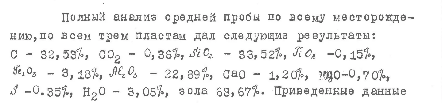
Average content (average sample across three beds, trenches, depth 2–4 m, weathering zone):
carbon 32.53%, ash 63.67%
- The graphite formed from carbonaceous rocks at the contact of a granite massif; the beds have sharp contacts and lie among shales and sandstones
- Four beds traced at surface: 300 to 2,120 m long, 2 to 8 m thick
- One intersection exposed 16.5 m, 27 m including the unexposed part; this is a single intersection, not the average bed thickness
- Individual trench samples: carbon from 4.11 to 51.69% (range across samples); the best single sample is carbon 51.69% with ash 43.77%
- 35 surface samples from a later re-study: carbon from 1.99 to 27.76%, ash from 55.69 to 92.97% (range across samples)
- Ore composition per the laboratory description: cryptocrystalline graphite 17%, carbonaceous matter 15%, andalusite 20%; very little crystalline graphite
- Flotation of 9 surface samples: carbon in the froth product rose only 1.5–2 times; the surface ore beneficiates poorly; not studied at depth
- Andalusite (a raw material for refractories): up to 20% in the ore, up to 60% or more in the hornfels; not assessed as a product
- Reserves, category C1, to a depth of 10 m for one bed: 93.9 thousand t (estimate under the classification of past years; the source does not specify whether ore or graphite; no approval record found)
- Geologists' forecast resources (handwritten estimate by the report's authors): on the order of 1 million t of graphite ore to a depth of about 50 m; no category given; this is a forecast, not reserves
- Level of study: historical mining (several hundred tonnes of sorted graphite), trenches, pits, chemical analyses; no drilling, not studied below 10 m
Report fragments

Source: archival geological reports and a geological map at 1:200,000 scale (scans in our archive)